
Many people who like traveling have their bucket list of the places which they want to visit in their life. Most of these places are the world famous and popular destinations like London, Paris, Bali, Iceland, or Morocco. But there are some travelers who know that there is really much more to visit and explore beyond these destination. And some places, somewhere beyond the horizon are really challenging. Read further about the Top 10 most challenging places to travel on the Earth!
If you are looking for the most beautiful views and landscapes on the Earth, you need to be better in geography and to look much further, where the tourism is not developed or totally missing. Some of these areas are so wild and extreme that only those who really love explorer’s adventures would go there to travel. Let’s see which are these areas- the most challenging places to travel.
Although our planet is extremely small in the cosmos, it is still much larger for us, who live here and travel on its surface. Many people travel a lot, but if you see a map of the Earth, showing the places where they travel, it would cover only a small area with the most popular destinations and countries. But there are vast territories outside this area, which remain almost unexplored, even today. And if you make a trip there, you can be surprised how much more our Earth can offer to us.
Table of Contents
Look at the map of the Earth
If you watch the map of the Earth, you can notice that the most developed and famous countries, as well as the countries with the longest history, are located in the Northern hemisphere, in the middle between the Equator and the North pole. The climate in this zone is subtropical or moderate. There you can find USA, Europe, China, Japan, and Korea. The only exception is Central Asia due to its dry climate.
It is same in the southern hemisphere, where in the moderate and subtropical zones you can find the southern (most populated and famous) part of Australia, New Zealand, South Africa, the southern part of Brazil, Uruguay, Paraguay, and the northern parts of Chile and Argentina.
With some exceptions, these mild-moderate zones are the easiest to travel and explore. But if you look outside- it is too cold, or too hot and wet. And there you can find some of the most virgin, unexplored, far from the tourist crowds and difficult to travel lands.

The most challenging places to travel
These lands are located in different zones, from the Equator to the coldest places on Earth. They are challenging for many reasons.
Natural environment
Most of these places are very scarcely populated due to their extreme climate and natural conditions. Rainforests are very rich in life but almost unsuitable for agriculture activity. Hot and cold deserts are too dry, with extreme temperature amplitudes. Many islands in the oceans are too isolated and again too hard for any development. High mountains- again, severe climate, too rocky and steep.
So these lands are difficult not only for living but also for travel. No wonder that some of them are totally uninhabited.
Special political status
Many lands of these areas lie in some autonomous regions, where you can’t just go with your passport and visa, but you need some special permissions. And these permissions can be very difficult to obtain. Examples are Tibet and some autonomous areas of Russia, such as Taimyria and Chukotka.
Danger from humans
Although these areas are very scarcely populated, you can face problems with local people living there. For example, there are some radical Islamist bands roaming in Sahara. There is some tension between local tribes in Papua and the government of Indonesia. There are some mafia groups operating in Amazonia.
Natural reserves
Some areas are prohibited not only due to their political status, but also because they are turned into natural reserves (which is good for the local nature, but makes our visit extremely difficult and complicated). An example is Changtang plateau in the northern part of Tibet, which is uninhabited zone. Other examples are some isolated islands like Heard and MacDonald and Bouvet.
Anyway, for those travelers who really love adventure in the spirit of Magellan and other famous explorers from the history, it is still possible to prevail all these obstacles and to make an unforgettable trip to some of the most beautiful, unknown and challenging areas on the Earth.

 Exploring the Earth is fantastic! However, there are various hidden dangers that may ruin your journeys. Don’t allow that to happen, or at least reduce the consequences as much as possible!
Include a travel insurance as a part of your trip preparation by pressing the button below:
This is the Top 10 of the most challenging places to travel on the Earth.
Most of the people would never include these places in their bucket lists. But for the travelers who love adventures- it’s a different story.
Amazonia
Geographical zone
Equatorial zone. Location: South America. Rainforest area around Amazon River.
Basic facts
Amazonia is actually a famous land, located in the north part of Brazil and parts of its neighboring countries Venezuela, Colombia, Ecuador, Peru, Guyana, and Suriname. But it is famous only from some movies, documentaries and our classes of geography in the school. Yes, there are some tourist companies, offering trips in Amazonia, but only in some limited areas.
Amazonia is well known as the largest rainforest area on the Earth. There are a lot of local Indian tribes, hidden in the jungle, near the mighty Amazon river and its tributaries. Some of these tribes are still undiscovered. Unfortunately, there are also criminals, as well as groups of people catching the advantage of the remoteness and the weak applying of the laws, who not only destroy the local nature but also can be hostile to the travelers who penetrate in “their” territories.
Routes
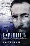
The best and the most challenging route in Amazonia is following Amazon river from east to west, or from west to east. There are some explorers who have accomplished it. One of the most significant travelers there is Mike Horn, who crossed Amazonia from east to west, as a part of his Zero Latitude travel on the Equator of the Earth.
Transport
There are only two ways of transport on this route in Amazonia. The first way is by boat on the river. There are some cruises from Manaus city in Brazil, but they don’t go too far. For the longest part of the route, you need your own boat, which can be eventually gotten from the locals. And the other way of transport is your own feet.
Red tape
Most of Amazonia is located in Brazil, and you don’t need anything else, but just a passport and visa for Brazil. But if you want to cross into the neighboring countries, you have to pass some restricted zones, and there are almost no convenient border checkpoints on such a route for crossing. So, such a route normally requires special exclusive permissions.
Challenges
There are a lot of challenges in Amazonia, outside of the tourist-developed areas around Manaus and a few other cities.
– It is the endless maze of rivers and jungle. Even the local can be lost in this vast landscape.
– It is the extremely rich wildlife. There are really A LOT of animal and animal species, and some of them are dangerous. You can be bitten by animals in the jungle, and animals in the waters.
– The plants can be also dangerous. They are so thick, some of them with thorns and even venom, so you have to be careful about them too.
– The ground can be dangerous too. In some areas, you have to pass swamps or just extremely difficult to walk places.
– And finally- people can be dangerous. As I mentioned above, there are illegal criminals, who have established their own territories, where they could do their crimes- either drugs or just destroying the jungle.
The reward
If you can prevail all these challenges, you can enjoy an unforgettable in the largest rainforest in the world, to dive in the beautify of the jungle and the rivers and to meet amazing people living there- the local tribes of the forest.

Check out some books and stories about the Amazon rainforest:

![]()

![]()

![]()

![]()
Papua
Geographical zone
Equatorial zone. Location: Oceania, Melanesia. Rainforest and mountain area.
Basic facts
Papua is one of the largest islands on the Earth. There is a high mountain range on its northern part, and plain southern part, richly covered by rainforest and rivers. Politically it is divided into West Papua, which is part of Indonesia, and East Papua, which is the independent state of Papua New Guinea.
Although it looks like a part of Sundanese Archipelago, Papua is a different world. Nature is different, and the people are different too. There are a lot of plants and animals, which are presented only here. And the local Papua people are not Asians, but Melanesians.
Routes
The main direction of a route in Papua is from west to east (and vice versa), from the “head of the turtle” (as the form of Papua is like a turtle) Chendravasih Peninsula, to the “tail”, beyond the capital of Papua New Guinea Port Moresby.
The routes can pass on the northern coast, on the mountain summit or on the southern part of Papua. And the southern version is the most difficult. Same as Amazonia, it is covered by an endless jungle and you can move there only by foot, crossing a lot of rivers and swamps. The mountain version is a little bit easier, because at least there are no swamps, and the forest is not too thick.
Transport
West Papua and Papua New Guinea have very limited opportunities for “normal transport”- bus, car or boat. It is only in limited areas around the bigger cities on the sea coast. But the interior of the island is really wild. Again, as in Amazonia, you can travel there only by local wooden boats or on foot. And it is even harder than Amazonia because there is no big river to follow, but only smaller rivers, which you can follow for a while.
Red tape
Since New Guinea is divided into two countries, there is a border between them, which requires a passport and visas in most cases. But since there is only one checkpoint, and it is on the north coast of the island, the rest of New Guinea can be crossed only by special permission or illegally.
Challenges
– Similar to Amazonia, there is an endless maze of rivers and jungle. Anyway, not such vast as Amazonia.
– Again, there are really a lot of animals in the jungle, some of them are venomous, and some of them (like crocodiles) are predators.
– The jungle itself. Same as Amazonia, it is extremely thick.
– The ground: In the mountain ridge the terrain is very difficult, and the jungle makes it even more difficult. In the plains of the south, the maze of rivers and swamps also make the crossing very difficult.
– The locals. There were some tribes in Papua, involved in cannibalism. Although there are no recent records of cannibalism in Papua, it can’t be said for sure that cannibalism is 100% disappeared.
The reward
As in Amazonia, you can experience one of the most undiscovered jungles in the world, here combined with mountains. It is especially exciting to cross it from coast to coast. And you can meet other unique people- the local Papua tribes.

Check out some books and stories about Papua:

![]()

![]()

![]()

![]()
Polynesia
Geographical zone
Ocean tropical and equatorial area. Scattered islands in the Pacific Ocean. Most of the islands are archipelagos of atolls.
Basic facts
Polynesia, as a part of Oceania, is scattered across the Pacific Ocean, covering a vast area, larger than Europe and Asia together. But the land part of this area is less than 1%, consisting of thousands of islands, most of which atolls (coral reefs, ring islands), usually gathered in archipelagos.
Now all these islands are part of French Polynesia and a few islands countries like Tonga, Samoa (East and West), Kiribati, Tuvalu, and some British and American overseas territories, including Hawaii. Polynesia also includes New Zealand, which however looks quite different than the tropical paradise of the small islands.
Some of the islands (such as Hawaii, Tahiti, Bora-Bora, Rarotonga and a few more) are developed tourist destinations. But most of the other islands are remote, wild, and many of them are uninhabited or only occasionally visited by the locals. As a whole, you can find the perfect “tropical island paradise” picture exactly there, in Polynesia, especially in the remote, far from the tourist crowds islands.
Routes
There are a lot of possible route versions, running mainly from west to east. The two main directions start from Melanesia or Micronesia. One of the versions ends in Hawaii, and the other ends in the easternmost Polynesian island- Rapa Nui. Further beyond, there is only a vast ocean with almost no islands, to the coasts of America.
Transport
Since the whole area consists of small islands in a vast ocean, obviously the main on land transport can be only by ship. There are ferries between the main islands within an archipelago, but not to all islands. And there are only a few inter-archipelagos ferries. But if you want to cross the whole Polynesia, you can do it by your own yacht.
Then, on dry land of the islands, there are local buses or taxis, but now everywhere. On the uninhabited islands, as well as the islands with very few people you have to walk on foot or sailing by your own boat on the inner lagoons of the ring islands. Other options for visiting this region is of course on a cruise ship. This is a cheaper and easier option with regular departures from Sydney and Brisbane during the Australian summer months of November through to February.
Red tape
Polynesia is divided politically between a few local countries, and territories of France, UK, USA, and Chile. So you need the normal border documents to cross from one country to another- passport and eventually visa. But there are some islands, which require special permission, either because they are natural reserves or military bases. Such an island is Midway, which is controlled by the US Navy.
Challenges
– The distances. Polynesia is really vast, and the water distances between archipelagos are huge.
– The sea storms. This is an ocean. The largest ocean on the Earth. So the sea storms are not uncommon.
The reward
The greatest reward of exploring Polynesia is to experience the most virgin, large and splendid tropical island paradise, feeling the freedom of the vastness. And at the same time, you can touch some last remains of the original Polynesian culture.

Check out some books and stories about the South Pacific and its scattered islands:

![]()

![]()

![]()

![]()
Sahara and the Arabian deserts
Geographical zone
Dry tropical area. Sand and stone deserts, mainly plain and some scattered dry mountains.
Basic facts
This is a vast territory, covered almost the whole northern part of Africa, and the whole Arabian Peninsula, which is divided only by the narrow Red Sea. Most part of this area is plain, but there are some isolated mountain ranges, such as Ahagar, Tibesti and Sarawat mountains in Arabia.
The whole area is dry and with small scattered exceptions (some of which called “oasis”) completely naked- without any plants, or only with some bushes. A large part of Sahara and Arabia is covered by sand deserts, other parts- by rocky or stony deserts. And the mountains are just a part of the same landscape- almost without any plants.
All this vast area is shared between the countries of Morocco, West Sahara, Mauritania, Mali, Algeria, Tunisia, Libya, Niger, Chad, Sudan, Egypt, Israel, Jordan, Syria, Iraq, Kuwait, Saudi Arabia, United Arab Emirates, Bahrain, Qatar, Yemen, and Oman.
Routes
The most interesting routes are from north to south. There are a few versions: along the Atlantic coast, crossing Ahagar mountains, crossing Tibesti mountains, following the Nile, and in Arabia- from Israel, through Hijaz range and Rub-al-Khali desert- to the coast of Oman.
Transport
There are a few roads, crossing Sahara and the Arabian deserts, and there are buses on them (but not on all roads). So using this way, you can pass a whole route through this area, but only through certain parts of it. The larger rest of Sahara and Arabia is completely wild and almost uninhabited, with exception of some oasis.
Maybe you can cross the deserts by 4×4 vehicle, but with high risk to be stuck in the middle of nowhere, especially in the sand areas. The only other options are crossing by camels or by your own feet. But camels now would be an extremely exotic and expensive experience, nearly impossible. Even the local nomads don’t cross the deserts by camels for long distances, as in ancient time, but they just go to the established roads.
Walking on foot is not less difficult since the main problem is the lack of water. But maybe it would be possible by support by someone else.
Red tape
Sahara and Arabia are divided between many countries. There are border checkpoints on the few roads crossing the area. But for the rest, the crossing is possible again only by special permission or illegally. Saudi Arabia has very difficult visa regulations for foreigners. It is made easier in November’2018, but the cities of Mecca and Medina remain closed for non-Muslims.
Challenges
– The climate and the lack of water. It is extremely dry. You may need more water than in “normal” conditions, and at the same time, it is very difficult to reach it. And if you find yourself without water, far from the nearest water source, you are doomed.
– Lack of food. There is no food in the desert. Only in some places, you can find insects or snakes to eat, and that’s all.
– The endless desert landscape. The landscape in this area is same hundreds, even thousands of kilometers (miles). You can easily lose an idea where you are.
– The local Islamic extremists. There are some Islamic terrorist groups, controlling parts of the desert in Africa, mainly in countries like Mali, Niger, Chad, and Sudan. Also currently there is a war in Yemen and Syria.
The reward
You can have one of the greatest feeling of freedom and vastness here, in the endless wilderness. And you can enjoy the beauty of the desert in its perfection, with the additional unique feeling from its crossing from end to end.

Check out some books and stories about the largest hot desert area on the Earth-
Sahara and the Arabian deserts:

![]()

![]()

![]()

![]()
Northern Tibet
Geographical zone
High mountain plateau, mainly dry. Covered by tundra or rocks. Altitude- mainly between 4600 and 5400 m
Basic facts
The Great Tibetan Plateau, part of the Greater Ranges area, is the largest and the highest plateau on the Earth. While its southern and eastern parts are populated, developed and some of the places (around Lhasa, Kailash, also in Sichuan, Yunnan, Qinghai, and Gansu) arranged for tourism, its north, especially northwestern part is completely wild and uninhabited.
This part of the Great Tibetan Plateau is called Changtang. Along with its eastern extension, called Kekexili, it covers an area, larger than France and Spain together, with zero population. A large part of Changtang is endorheic, separated from the ocean. There are vast plains with scattered snowy peaks, rising more than 6000 m altitude. And there are many lakes, most of which are saline.
Routes
Changtang plateau can be crossed from north to south, but the most challenging version is from west to east. Starting from Karakoram or Kashgar, a possible route leaves the main road to Lhasa and cross Changtang on its length until the other road from Golmud to Lhasa. Then it can proceed further east to Yushu and Amnye Machin ranges to the easier and milder areas of Qinghai, Sichuan and Gansu provinces.
Transport
There are no roads in the uninhabited zone of Changtang. Now there are some very expensive expeditions, using 4×4 vehicles to cross the plateau, but even they don’t cross it on too long distance. There are also reservation guards, who also penetrate in the area by their vehicles, but again- not too far. In fact, there are large areas, where maybe humans have never set their feet.
The only other options are by bicycle (which can be very difficult too, especially in some stony or even sandy areas) or just on foot. There are only a few recorded cases of crossing Changtang on foot. The most challenging of them is even filmed in “77 Days” movie from 2017, based on a real event.
Red tape
This area has very complicated red tape requirements. First, this is entirely within China, so you need your passport and a Chinese visa, that’s the basic. But then, a large part of it is on the territory of TAR (Tibetan Autonomous Region), which requires an organized tour and travel permit. That’s not all. Third- it is a natural reserve, which requires special permission on a very high price (if they give such document at all). And finally- if you want also to climb one of the peaks, you need one more permission for climbing.
Challenges
– The high altitude. Most of the area of Changtang is located between 4700 and 5300 m altitude. There are no settlements (cities or villages) in the world, located such high and normally it is too high for humans to live constantly.
– The harsh weather conditions. It is generally dry, but the temperature may suddenly drop. There is a danger of occasional storms.
– Some wild animals. There are wolves and bears living in Changtang, as well as wild yaks. They may be dangerous for a traveler.
– The ground. There are some sandy areas with floating sands, which can be dangerous. Also, there is a possibility of local floods.
The reward
You can enjoy some of the most virgin, breathtaking and unique landscapes on the Earth, and the pleasure of its infinity, as well as its rich wildlife.

Check out some books and stories about the Great Tibetan Plateau:

![]()

![]()

![]()

![]()
Mongolia-Altai
Geographical zone
Moderate dry climate. Mainly grasslands and deserts. Plains and mountains, covered by scattered forests.
Basic facts
It is a vast area, located between Tibet and Siberia. It is mainly plain, but in relatively high altitude- around 1000 – 1500 m. There are mountain ranges, mainly in its northwestern part. The southern part is drier, dominated by Gobi Desert– mainly sandy or stony wilderness. An extension from this area is located in Xinjiang, between Tianshan and Kunlunshan mountain ranges- this is Takla Makan sand desert.
The northern and eastern parts of this area are covered by grasslands, and some scattered forests. The mountain ranges in the north include Altai and Sayans. Also, there are some rivers and lakes, such as Hobsgol Lake and Selenga River.
The whole area is very scarcely populated. There are only some remote towns, villages and nomad settlements. The tourism is almost undeveloped and consists mainly of some adventure tours on certain routes. Everything outside all this is wild, vast and uninhabited.
Routes
There are many route opportunities, mainly running again from west to east. These routes can cross Altai and Sayan mountains on their summits, Gobi desert from Altai, through the sand areas to the grasslands on the east. Takla Makan is challenging to be crossed from south to north too.
Transport
There are some roads, crossing this vast area. And same as Sahara and Arabia, there are buses only on a few of them. The only other way of transport can be cars, but only on some better sections of the road, 4×4 vehicles and passing trucks. It is possible you drive a 4×4, and go off-road, but in some areas, it is risky too.
Other ways can be crossing by camel or horse. Again- it depends on locals, and it is unlikely that they would assist you for too long distance.
Again, the other options are by bicycle, but not in the sandy areas, and on foot. There are some recorded cases. Since it is easier than Sahara, it is more possible.
Red tape
This area is divided between China and Mongolia. There are a few checkpoints between the two countries, but it can be difficult for foreigners from a third country to cross through them. Once crossed, basically, there are no other requirements for Mongolia, but for Xinjiang province in China is different- many areas, especially near the border, are restricted or require special permission.
Challenges
– The weather. It is dry, but sometimes there are unpredictable storms- thunderstorms in summer and snowstorms in winter.
– The vastness of emptiness. You can walk hundreds of kilometers and don’t see anything but only an endless grassland or desert, without any mountains. You can lose an idea where you are.
– The same challenges as Sahara in the desert areas. Sand, lack of water and food.
The reward
Again, you can experience one of the best feeling of endless infinity of stunning landscapes of grasslands and deserts, under the pure blue sky. You can also meet the famous local Mongol nomads.

Check out some books and stories about Mongolia and its grasslands:

![]()

![]()

![]()

![]()
Siberia
Geographical zone
From cold moderate to polar climate. Mainly plains, mountains in the far east, a lot of rivers. Covered by taiga forests and tundra in the north.
Basic facts
This is a huge area, covered the whole northern part of Asia, from Ural to Chukotka, and from China and Kazakhstan to the Arctic Ocean. It is mainly plain, rich in waters- rivers, lakes, and swamps, and covered by taiga forests in the south, and tundra in the north. Its far eastern part is more mountainous.
Siberia is well known as the coldest place in the northern hemisphere of the Earth. Actually, it is coldest only in winter, when the temperatures can drop lower than -50C. But summer is warm, even hot in some areas. Thus Siberia has the biggest temperature amplitude on the Earth.
The whole area is located in Russia. It is very scarcely populated too, some parts- completely uninhabited. The only tourism is developed in some parts of the Southern Siberia- mainly around Baikal Lake. Another destination that starts becoming a future tourist destination is Kamchatka. The rest Siberia, with exception of some local towns and villages, is very, very wild.
Routes
Since Siberia is really vast, there are many routes opportunities too, mainly running from west to east. The most challenging are two main versions: A taiga route, starting from Ekaterinburg, crossing Khanty-Mansya, Yenisei, Evenkia, Yakutia and arriving at Chukotka. And a tundra route, starting from Komi and Salehard, then running south of the Arctic Ocean- again to Chukotka. There are also many opportunities for crossing Siberia from south to north.
Transport
The most famous road is the Trans Siberian Highway, which runs on the southern edge of Siberia, both as railroad and automobile road. But if you want to penetrate deep northward, there are not too many options. There are roads connecting Ekaterinburg with Khanty-Mansyisk, and Never with Yakutsk and Magadan, as well as few more shorter roads, and that’s all. The rest is wild, almost uninhabited vastness, where you can walk hundreds of kilometers (miles) without seeing any road (I mean a dirt road or even a path), and any human.
However, there are some other options. Siberia is very rich in rivers. You can float on the three main rivers Ob, Yenisei and Lena, and their tributaries, as well as some smaller rivers in the north. Some river sections have cargo service and even tourist ship service in very limited areas. But for the rest, you have to rely on locals, if you find them at all. Or you can bring your own boat.
But again, when the river finish and you have to cross a watershed to another river, you can only walk. Maybe very, very long.
Siberia in winter is different. Everything is covered by snow, and the rivers are frozen. Then you can cross by ski, which is relatively faster. However, don’t forget that the terrain is still very difficult. And of course, don’t forget the extreme winter cold.
Red tape
Siberia is entirely within Russia, so you need a passport and Russian visa. But for some autonomous regions like Dolgano-Netetzia and Chukotka you need another special permit, which is usually difficult and complicated to be obtained.
Challenges
– The cold in winter. Siberia is well known as the coldest place on the Northern Hemisphere. It is particularly cold in Eastern Yakutia, around Verhoyansk and Oymyakon, where the absolute record of -71°C was registered. You need very good gear if you go there in winter.
– The endless uninhabited area. You can walk hundreds of kilometers (miles) and not meat any human, even a trace of human presence, in a landscape, which looks the same.
– The mosquitos in summer. They are big and aggressive, and they are particularly bad near the swamps and lakes. You need good protection against them.
– The wild animals. There are bears, wolfs and other animals, who also may become aggressive, especially if they are hungry.
The reward
Crossing Siberia, especially from west to east, you can feel another unique feeling of vastness and infinity- the vastness of this stunning nature- its forests, rivers, lakes, and tundra, until you arrive at its end in Chukotka.

Check out some books and stories about Siberia:

![]()

![]()

![]()

![]()
Greenland
Geographical zone
Polar climate. Covered by a continental glacier, reaching 2,5 km thickness.
Basic facts
Greenland is the largest island on the Earth. Most of it, with exception of its coasts, is covered by a thick glacier. And the only tundra can be found in its coastal areas. The rest is only endless ice and snow. The northernmost point of Greenland is actually the northernmost dry land on the Earth, closest to the North Pole.
Greenland’s population is settled only in some towns on the coast. The whole other area of the island is completely uninhabited. The only tourism is in some adventurous forms, again only around the coast of the island.
Routes
Greenland is challenging to be crossed from east to west. But more challenging is a crossing from south to north (or vice versa), on its length. Nevertheless, all these route versions cross its continental glacier.
Transport
In Greenland, there are some short roads only at the coastline, connecting the local settlements. But the interior of Greenland is uninhabited and there are no roads on the glacier. So the only ways to cross Greenland is by ski or again on foot. Mike Horn wrote about such experience in his book Conquering the Impossible.
Red tape
Greenland is one of the easiest territories concerning red tape. You only need a passport or passport with Greenland visa (depending on which country are you from). It is formally a part of Denmark, but not part of Schengen, so the visas for Greenland and Denmark are different.
Challenges
– The cold. It is the second coldest place on the Northern Hemisphere, and it remains cold even in summer. You have to be well prepared.
– The endless white landscape. You can walk many days seeing the same landscape of white and blue (or only white in bad weather), and nothing else. You can easy lost any idea where you are.
– The glacier cracks. The glacier is safe in the middle, but there are many cracks at its ends. If there is fresh snow on them, you may fall in a crack, and it most likely would be fatal.
The reward
Crossing Greenland is another unique experience of another feeling of vastness, this time the vastness of the white. And finishing at some point of the Greenland coast is a real pleasure of satisfaction.

Check out some books and stories about Greenland:

![]()

![]()

![]()

![]()
Antarctica
Geographical zone
The coldest polar climate. The largest glaciated continent on Earth. Its glacier reaches 3,5 km thickness.
Basic facts
Antarctica is the coldest continent, completely uninhabited, with exception of some scientific expedition and their polar bases. It is covered by the largest continental glacier. Only some small ground areas, free from ice, can be seen on the parts of the coast.
Here, in Vostok station, located deep inside the continent, is registered the coldest temperature ever- -89C (there is an unconfirmed data about even colder temperature- -91C). The only tourism is some luxury cruises, organized only to the coasts of Antarctica. And there are one or two companies, who occasionally arrange trips to the South Pole, at extremely high price.
Routes
Obviously, Antarctica is most challenging to be crossed in the middle, passing through the South Pole. It can be done from the Antarctic Peninsula or from another starting point.
Transport
Antarctica is even more difficult than Greenland. First, because unlike Greenland there are no settlements on the coastline and no roads. And second, because crossing the continent in the middle is much longer than Greenland. So, again the only way to cross is by ski or on foot. There are some explorers who made it, and the first of them- Amundsen and Scott are very famous. But there are such travelers today too. Again, Mike Horn is one of them.
Red tape
Antarctica is a zone, which doesn’t belongs to any country. So no passport and visa are required. However, since it is a subject of the Antarctic Treaty Protocol for Environmental Protection, travel permission is required, which is normally obtained by travel companies. It is possible to be obtained without a travel company, but it’s more difficult and complicated. Otherwise, you can go there illegally, which can be a not good option in some cases.
Challenges
– There are the same challenges as in Greenland, but here they are even more severe. First, Antarctica is larger. Second- it is colder, with stronger winds sometimes. And third- it would be more difficult to expect rescue help there.
The reward
Crossing Antarctica has a similar reward like Greenland, but here you can add the conquering of the South Pole.

Check out some books and stories about Antarctica:

![]()

![]()

![]()

![]()
Isolated Sub-Antarctic islands
Geographical zone
Cold moderate wet climate. A few islands, scattered in the southern parts of Atlantic, Indian and Pacific Oceans. Covered only by rocks and some tundra.
Basic facts
The ocean area around Antarctica is shared between the south parts of Pacific, Atlantic, and Indian Oceans. It is the largest and harshest water territory on the Earth, with regular rain and snowstorms, strong winds and huge waves, which no land and mountain can stop. Only Patagonia, the southern part of South America penetrates deep into this area, approaching closer to Antarctica.
The whole area is covered by water. There are only a few scattered islands: South Georgia, South Sandwich and South Orkney Islands near Patagonia, and the isolated Bouvet Island in the Atlantic Ocean. In the Indian Ocean are Marion, Crozet, Kerguelen, and Heard and MacDonald Islands. And in the Pacific Ocean is only Macquarie Island.
All these islands are uninhabited. There are only some scientist bases on them. The most isolated and difficult island to reach is Bouvet. Another extremely difficult island is Heard Island, now turned into a natural reserve.
Routes
All these islands can be a stops on a cruise to Antarctica. But more challenging would be a route, joining the islands in a chain around Antarctica, completing a full circle. It can start from Patagonia and end in Patagonia.
Transport
Obviously the only way of traveling on land there is by ship. But there are no passenger ships and no cargo ships to these islands. Anyway, there are some options. First- there are some expensive cruises, arranged by travel companies, which visit some of these islands (usually only South Georgia, South Sandwiches and South Orkney islands). Also, there are some scientific expeditions to every island, but it is usually difficult to expect them to agree to take you on board. Finally, you can probably go there by your own yacht, but it is very risky and may be deadly due to the extreme weather conditions.
Red tape
The islands, located south of the 60th parallel have the same status as Antarctica. As for the other islands- they belong to a few countries- Norway (Bouvet), UK (Marion), France (Crozet and Kerguelen) and Australia (Heard, MacDonald, and Macquarie). So they require special permits to visit these islands, anyway it is unlikely that someone would check your permits. Hear and MacDonalds are completely restricted for visitors, being a natural reserve.
Challenges
– The bad weather, which is almost constant. It is not very cold, but it is extremely wet and windy.
– The big ocean waves. They are furious, and they remain big even in quiet weather since no coast can stop them.
– Landing on an island shore. It is especially difficult at Bouvet Island, where no wharf exists and the wave surf is really furious.
– Remoteness. These islands are some of the remotest pieces of land, separated by thousands of kilometers (miles) from the nearest continent. Again, Bouvet Island is most difficult, since there is only a weather station there, which often remains without people.
The reward
Exploring these remote islands can give you a unique feeling of the vastness of our “small” planet. You can not only enjoy the island’s breathtaking views but also experience the feeling to be really far from the civilization of the continents.

Check out some books and stories about the isolated Sub-Antarctic islands:

![]()

![]()

![]()

![]()
Journey to the far ends of the world
Of course, there are many other challenging places on the Earth- the savannas and jungles of Africa, the deserts of Namibia and Botswana, the wilderness of Iran and Central Asia, the rest of the Great Ranges in Asia, the remote forests of Southeast Asia, the deserts of Australia, the endless mountain chains of the Rocky Mountains in North America, the tundra and taiga in Canada and Alaska, the grasslands, mountains and forests of Patagonia, the challenge of the Arctic Ocean and the North Pole, even some remote and less known corners of Europe, and many more.
But these 10 places are the best in my opinion. Maybe they will be changed in the near future (unfortunately, with the pollution and climate change, they will be changed for worse) and maybe they would be not so challenging soon. But now, in my opinion, these most challenging places to travel are a real “bucket list”, which still remains unreached.
Forest, deserts, wild mountains, glaciers, endless ocean with scattered atolls,
and endless, endless vast spaces…
WATCH MORE BELOW ABOUT…
Forests on the Earth:
Deserts on the Earth:
Highest and most challenging mountains of the Earth:
…or the vast spaces of Oceania and the tiny atolls, scattered in the ocean:
Go on a journey to the far ends of the Earth with the stories of some of the most extreme explorers!

![]()

![]()

![]()

![]()

![]()
![]()

![]()

![]()
Disclaimer: Journey Beyond the Horizon is a participant in the Amazon Services LLC Associates Program, an affiliate advertising program designed to provide a means for us to earn fees by linking to Amazon and affiliated sites at no additional cost to you.
Like it? Pin it here⇓! Follow us in Facebook, Twitter and Instagram!


You may also like


Hi, we are Krasen and Ying Ying. Krasen is from Bulgaria, and Ying Ying is from China. We are passionate about geography and history, and we believe that the best way to experience it is by exploring the Earth in reality, not in a school, and not virtually.
So, we created this blog Journey Beyond the Horizon, where we share geographical knowledge, travel guides and tips how to experience it when you explore our planet, and a lot of inspiration.
And we wish you a happy journey, not just virtually, but most of all- in reality.
Enjoy!

)