
Many long-distance expeditions eventually reach places where continuous roads no longer exist. New Guinea is often assumed to be one of them.
At first glance, that assumption seems reasonable. Dense rainforest, one of the world’s highest tropical mountain ranges, enormous river systems and the political division between Indonesia and Papua New Guinea all suggest that crossing the island overland should be nearly impossible.
The reality is far more complex.
New Guinea is not a roadless island. Nor is it a fully connected one. Instead, it is an island where roads repeatedly appear, disappear and reappear, forcing travellers to change not only direction, but often the very mode of movement.
This article examines New Guinea from the perspective of long-distance route continuity. Rather than asking simply how far a vehicle can drive, it explores where roads remain practical, where they no longer do, and how rivers, coastal transport and local boats become part of a continuous expedition across one of the world’s most challenging islands. Within the broader Crossing Eurasia project, New Guinea represents one of its most distinctive route barriers.
Table of Contents
Where New Guinea Appears in Long-Distance Routes
This article follows a west-to-east perspective, not because it is the only possible way to cross New Guinea, but because it represents one of the most natural approaches for long-distance overland travel.
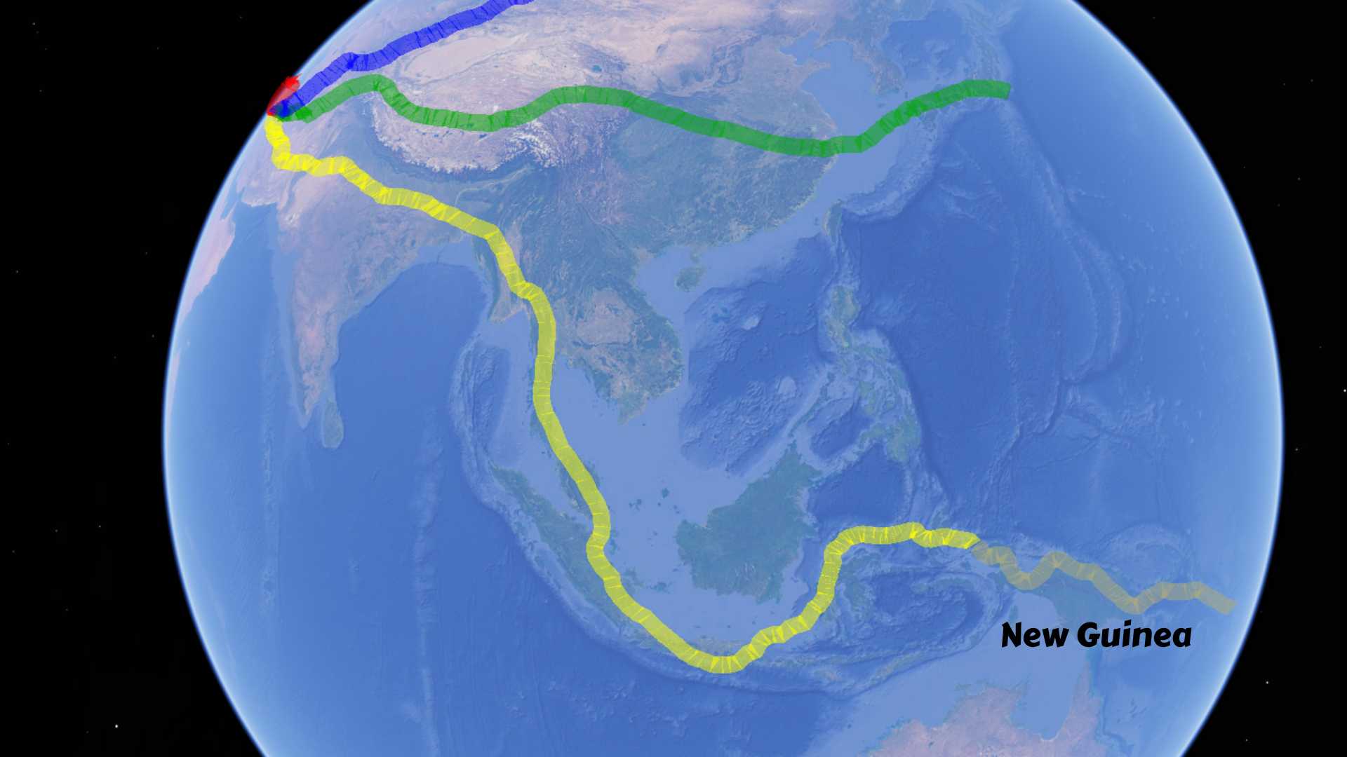
From mainland Asia, roads and ferries allow remarkably continuous movement through the Indonesian archipelago. One island leads naturally to the next until the route eventually reaches Sorong, at the western tip of New Guinea. Up to this point, sea crossings remain relatively short and regular, allowing vehicles to continue with comparatively little interruption.
New Guinea changes that pattern. Here the challenge is no longer crossing water between islands, but maintaining continuity across one enormous island whose roads, rivers and mountain ranges rarely follow the same logic.
For this reason, New Guinea occupies a unique position in long-distance route planning. It is neither simply another island in Indonesia nor merely the western edge of Oceania. It is the geographical transition where continental-style overland travel begins to evolve into something fundamentally different.
Example: Crossing Eurasia — Southeast Branch
One example of this route logic is the southeastern branch of a Eurasian crossing.
For a route approaching through South Asia, reaching Southeast Asia may first require overcoming the India–Myanmar route barrier. After reaching Southeast Asia, the expedition leaves the continuous Eurasian landmass and enters the Indonesian archipelago.
Progress becomes a combination of driving and ferry crossings, gradually advancing eastward through Java, Bali, Lombok, Sumbawa, Flores, Timor and the islands beyond until reaching Sorong.
At first glance, New Guinea appears to be simply the final island in that sequence.
In reality, it marks the beginning of a completely different geographical problem, a new chapter after crossing Eurasia on its southeastern version. The ferries that connected the Indonesian islands no longer solve the main challenge. Instead, the expedition must adapt to an island where roads, rivers and coastal transport repeatedly replace one another.
Other Long-Distance Route Concepts
The same geographical challenge appears in many other expedition concepts.
Travellers approaching from Australia may view New Guinea in exactly the opposite direction. One possible route crosses Torres Strait from Cape York into southern Papua before continuing northward across the island toward Indonesia and mainland Asia. Others may approach New Guinea as part of a broader journey linking Melanesia with Southeast Asia or exploring the western Pacific island chains.
Although these routes differ greatly in direction and objective, they all encounter the same fundamental question.
Reaching New Guinea is rarely the greatest difficulty.
Maintaining continuous movement across it is.
Why New Guinea Is Different
New Guinea does not challenge overland travel because it lacks roads.
It challenges it because no single transport system dominates the island for very long.
Roads, rivers, mountains and coastlines repeatedly take turns shaping movement. Understanding how these systems interact is far more important than simply locating roads on a map.
Before following the route beyond Sorong, it is therefore worth understanding why New Guinea behaves so differently from almost anywhere else in the world.
Physical Geography
At first glance, New Guinea appears to be simply one of the world’s largest islands. On the ground, however, it is a succession of geographical barriers layered one behind another.
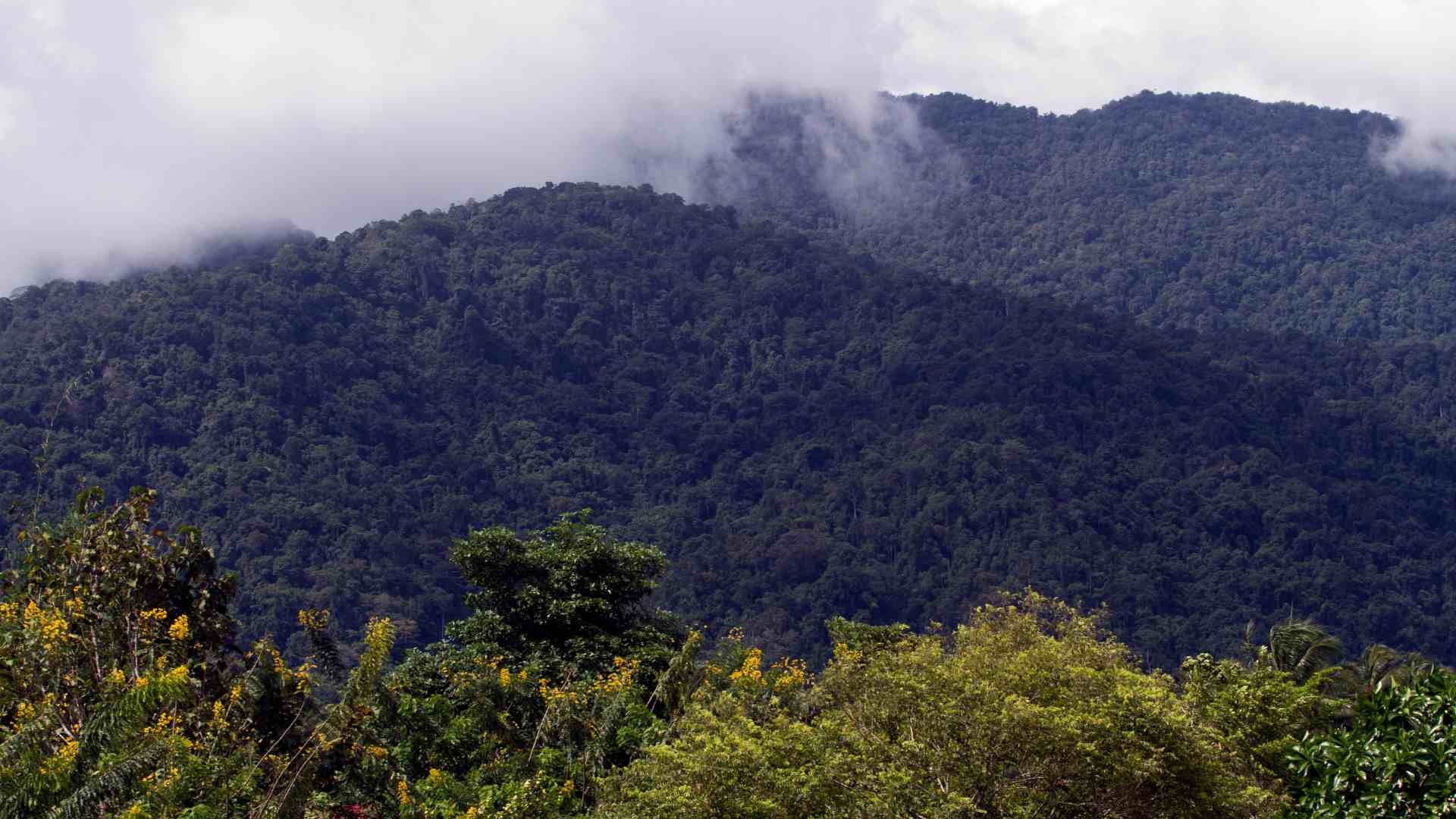
A continuous mountain spine rises above 4,000 metres through the centre of the island, separating the northern and southern lowlands. Beyond the mountains lie enormous rainforest basins, extensive swamps, powerful river systems and some of the wettest tropical landscapes on Earth.
None of these features makes overland movement impossible by itself. Together, however, they constantly force transport corridors to change direction, climb through narrow mountain valleys or disappear entirely. The result is not a complete absence of roads, but a road network that develops in isolated corridors rather than across the island as a whole.
Human Geography
The human geography follows a similar pattern.
Although the western half belongs politically to Indonesia, most indigenous inhabitants are Papuans, culturally part of the wider Melanesian world rather than the Austronesian societies that dominate much of Indonesia. Hundreds of distinct ethnic groups and languages reflect thousands of years of geographical isolation between valleys, mountain ranges and river basins.
Population is concentrated mainly along the coasts, around a handful of larger towns and within several fertile highland valleys. Between these areas lie vast expanses of rainforest, wetlands and rugged mountains where permanent settlement remains sparse.
This pattern explains why many roads end where they do. In New Guinea, roads are built primarily to connect people, not empty terrain. Large areas simply never developed the settlement density needed to justify continuous road construction.
One Island, Two States
Geographically, New Guinea is a single island.
Politically, it is divided between Indonesia in the west and the independent state of Papua New Guinea in the east.
The modern border reflects twentieth-century political history rather than natural geography. Mountain ranges, river systems and indigenous Papuan communities continue across the international boundary with little regard for administrative lines.
For the traveller, however, the transition is significant. Crossing New Guinea eventually becomes not only a geographical challenge but also an international border crossing between two countries with different transport systems, infrastructure priorities and administrative procedures.
Security and Access Reality
Terrain is only one factor determining whether movement is actually possible.
In parts of Indonesian Papua, particularly some remote highland districts, a long-running low-intensity separatist conflict occasionally affects travel. Conditions vary considerably from one district to another. The main Trans-Papua corridor generally remains accessible, while more remote areas may experience temporary restrictions or changing security conditions.
Papua New Guinea presents a different reality. Here the principal concerns are violent crime, occasional tribal conflict and the limited presence of state institutions outside major towns. Even where roads exist, local security conditions may become a more important planning factor than the terrain itself.
For long-distance expeditions, access therefore depends not only on geography but also on current local conditions.
Roads Without Continuous Movement
Perhaps the most surprising discovery for many travellers is that New Guinea possesses far more roads than its reputation suggests.
During the past two decades, both Indonesia and Papua New Guinea have expanded their road networks considerably. In western New Guinea, the Trans-Papua Highway now connects regions that until recently were separated by days of walking or air transport. Papua New Guinea is likewise extending its national network through the ConnectPNG programme, although progress remains uneven.
Yet the island still behaves differently from most continental road systems.
Rather than forming one continuous network, New Guinea consists of regional transport systems connected only intermittently. A road may continue for hundreds of kilometres before meeting a river system, a swamp, a mountain barrier or a section where construction has yet to catch up with geography. Even where roads exist, landslides, flooding and heavy tropical rainfall continue to influence their reliability.
For the expedition traveller, this distinction is crucial.
Road access is not the same as route continuity.
A vehicle may travel surprisingly far across New Guinea, only to discover that the next stage of the journey requires a bicycle, a village boat or a river rather than another road. The challenge is therefore not simply finding roads, but understanding when one transport system gives way to another. Preparing for that change requires a modular system of gear for hot, wet and roadless terrain, with critical items protected and the essential load ready to transfer from vehicle to bicycle, boat or foot travel.
Reaching Sorong: The Last Major Gateway
Having examined New Guinea as a geographical system, the next question becomes practical: what actually happens when an overland expedition reaches the island?
For a west-to-east journey through the Indonesian archipelago, that point is almost always Sorong. Here, the challenge changes. The ferries that connected the islands of Indonesia have done their job. From this point onward, the expedition depends primarily on the geography of New Guinea itself.
The question is no longer how to reach the island.
It is how far the island itself will allow continuous movement.
Why Sorong Matters
Located on the northwestern tip of the Bird’s Head Peninsula, Sorong is the principal western gateway to New Guinea. Regular passenger and vehicle ferries connect it with eastern Indonesia, making it the natural arrival point for overland expeditions approaching from mainland Asia.
Originally a small coastal settlement, Sorong expanded rapidly during the twentieth century through oil development and later became one of western New Guinea’s principal commercial centres. Today, its population reflects both the indigenous Papuan heritage of the region and decades of migration from elsewhere in Indonesia.
Internationally, Sorong is best known as the gateway to Raja Ampat, one of the world’s premier diving destinations. For the overland traveller, however, its significance lies elsewhere. It represents the point where thousands of kilometres of roads and ferries across Asia and Indonesia finally reach New Guinea—and where the island begins to determine the rhythm of the expedition.
Leaving Sorong: Following the Last Continuous Road
The first surprise comes almost immediately after leaving Sorong.
Contrary to the island’s reputation, the road does not end.
Instead, the Trans-Papua Highway heads east across the Bird’s Head Peninsula on a modern road that would not seem out of place elsewhere in Indonesia. Rivers are crossed by permanent bridges, villages follow one another at regular intervals, and long sections are fully paved. Although conditions still vary locally, this is no isolated jungle track.
The route continues through Manokwari before following the northern coast toward Nabire. During the past two decades, missing links have gradually been completed, transforming what was once a series of disconnected regional roads into a largely continuous corridor across western New Guinea.
For an expedition arriving from Southeast Asia, this changes the psychological picture completely.
After so many ferries across the Indonesian archipelago, New Guinea does not initially feel like the end of the road. Quite the opposite—it encourages the traveller to believe that simply continuing east may be enough.
That confidence, however, proves to be only the beginning of the story.
Beyond Nabire, the road turns away from the coast and begins climbing toward the Central Highlands, where New Guinea starts revealing the geography that has made the island one of the world’s most challenging overland frontiers.
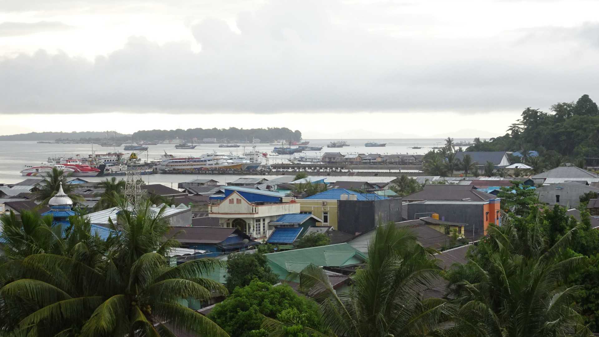
Photo by Lord Mountbatten, via Wikimedia Commons (CC BY-SA 4.0)
Into the Central Highlands: The Island’s Only Through-Route
Beyond Nabire, the expedition reaches one of the most important decisions of the entire crossing.
The obvious question is whether it would be easier to avoid the mountains altogether and simply continue along one of New Guinea’s coasts.
Surprisingly, the answer is no.
The island’s highest mountains provide not the greatest obstacle to eastward movement, but the only realistic continuous corridor across it. Understanding why is the key to understanding New Guinea itself.
Why the Mountains Become the Only Option
Looking at a map, the northern coastline appears to offer the obvious solution. Instead of climbing into the mountains, why not simply follow the Pacific coast all the way to Jayapura?
The geography quickly explains why.
North of the Central Highlands, countless rivers descend from the mountains through broad rainforest lowlands before reaching the Pacific. Few are bridged near their lower courses, and no continuous coastal highway links them together. Instead, short regional roads connect individual towns before ending at another river or disappearing into the forest.
The southern lowlands present an even greater challenge. Vast swamps, floodplains and slow-moving rivers dominate the landscape, while settlements become increasingly sparse. Roads exist, but only as isolated local networks serving individual communities rather than forming a continuous eastbound corridor.
In theory, both coasts remain passable for a determined expedition. In practice, however, such a journey would require repeatedly abandoning the vehicle and combining jungle trekking, river travel and local boats through some of the most remote terrain on the island.
Paradoxically, the Central Highlands offer the only realistic through-route. Rather than avoiding the mountains, the Trans-Papua corridor turns inland because the mountain valleys provide the only place where long-distance road continuity can be maintained.
Following the Trans-Papua Corridor
Beyond Nabire, the character of the expedition changes completely.
The road leaves the coast and begins climbing into the Central Highlands. From this point onward, the journey is no longer measured simply by kilometres, but by terrain.
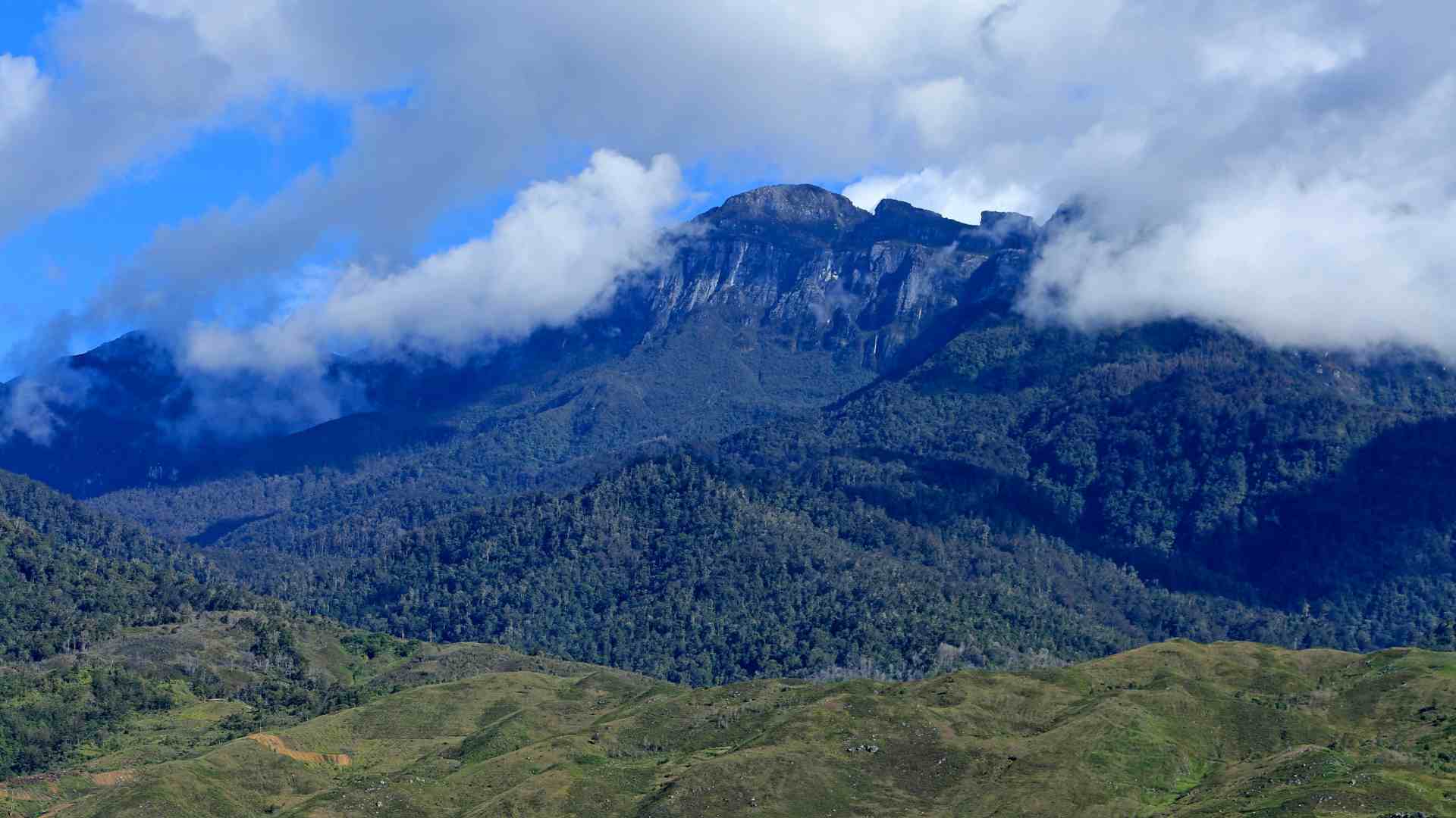
Unlike many mountain roads, the Trans-Papua corridor does not merely cross a single mountain range. It remains within the highlands for hundreds of kilometres, following valleys, crossing passes and winding endlessly through one of the world’s most rugged tropical mountain systems. The expedition does not simply cross the mountains—it travels through them.
Deep river gorges, steep slopes and countless ridges force the road into an almost continuous sequence of climbs, descents and tight bends. Bridges span fast-flowing rivers, while landslides, heavy rain and dense mountain cloud become part of everyday travel rather than exceptional events.
After an entire day behind the wheel, the expedition may appear to have advanced only a short distance on the map. The road gains progress not by cutting directly across the mountains, but by patiently negotiating every valley, ridge and pass that the terrain allows.
This is not a highway designed for speed. It is a corridor that has been engineered around the geography rather than imposed upon it. Every bridge, retaining wall and mountain bend reflects another obstacle that could not simply be crossed in a straight line.
For anyone attempting to drive across New Guinea, this becomes the defining section of the journey. The challenge is no longer finding a road, but following one of the few corridors through a landscape that rarely permits direct movement.
A Road, Not a Highway
By this point, the question has changed once again.
The issue is no longer whether a road exists.
It does.
The real question is what kind of road it is.
The Trans-Papua corridor should never be imagined as a fast highway crossing the island. Even where sections are fully paved and recently upgraded, it remains a mountain road passing through one of the wettest and most unstable tropical environments on Earth.
Heavy rainfall, landslides and flooding continue to influence travel, while bridges, culverts and retaining walls are often just as important as the road surface itself. Construction and improvements continue, gradually removing former gaps and making the corridor more reliable than it was only a decade ago. Even so, every new bridge solves only a local engineering problem. The geography itself remains unchanged.
Road continuity now exists across Indonesian New Guinea. Transport continuity, however, still depends on weather, maintenance, local conditions and, in some districts, security. The road does not conquer the mountains. It simply negotiates a passage through them.
Wamena and the Eastern Highlands
After the long climb through the Central Highlands, Wamena changes the character of the expedition once again.
Situated in the Baliem Valley, it is one of the most important population centres in the interior of New Guinea. Rather than being an isolated mountain settlement, Wamena functions as the hub of an entire highland region, with local roads spreading across the valley to surrounding villages and agricultural communities.
In that sense, Wamena represents something unusual in New Guinea: not the end of a road, but the centre of an independent mountain transport system.
Yet the journey is far from over.
Beyond the Baliem Valley, the road must still descend through difficult terrain toward the northern coast. The route becomes more connected, but it remains governed by exactly the same realities that shaped the climb: mountains, weather, maintenance and the constant need to adapt to the landscape.
Toward Jayapura
Beyond Wamena, the road begins its long descent toward the Pacific.
Mountain ridges gradually give way to lower foothills around Elelim before the route finally reaches the coastal plain. The endless climbs become long descents, the air grows warmer, and dense tropical forest once again replaces the cool mountain landscape.
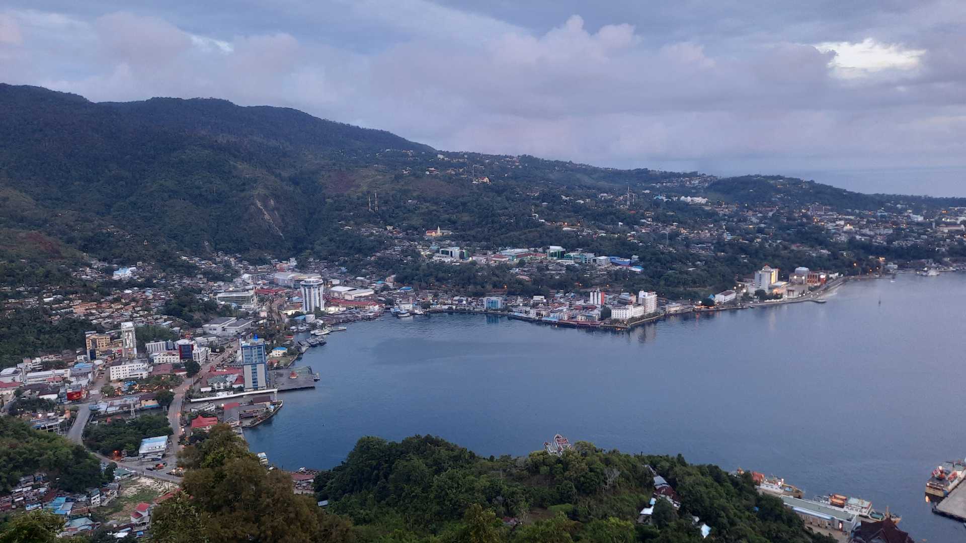
Even here, however, the road never becomes fast. Every valley, bridge and bend continues to follow the terrain rather than ignoring it. Eventually, the expedition reaches Jayapura, Indonesia’s easternmost major city and the end of the Trans-Papua corridor. It is one of the most surprising moments of the entire crossing.
After everything New Guinea seemed to promise—towering mountains, rainforest and isolation—the vehicle has, in fact, crossed the whole of Indonesian New Guinea. Not because the terrain became easier, but because engineers gradually learned to work with it rather than against it. The journey, however, is far from over.
Just beyond Jayapura lies the international border with Papua New Guinea, where the nature of the challenge changes once again. The mountains no longer dominate the expedition. Instead, a new transport geography begins—one shaped not only by roads, but increasingly by rivers, coastlines and the fragmented road networks of Papua New Guinea.
Crossing into Papua New Guinea
Reaching Jayapura feels like a major achievement.
After thousands of kilometres across Southeast Asia, the Indonesian archipelago and the Central Highlands of New Guinea, the road finally arrives at the international border.
At first glance, it seems that the hardest part is over. Cross into Papua New Guinea, continue east, and the island crossing should simply carry on.
The reality is more complicated.
The border does not end the journey, but it does end one transport system. Beyond it begins another road network, built under different historical, economic and geographical conditions. The route continues, but its continuity has to be evaluated again from the beginning.
Border Crossing Reality
After the long drive across Indonesian New Guinea, the Skouw–Wutung border crossing comes almost as a surprise. Current visa requirements should always be checked before planning the crossing.
Rather than a remote jungle track, it is a formal international crossing with paved roads, immigration buildings and customs facilities on both sides. The road continues beyond the border toward Vanimo, and for the first time in many days the next stage appears straightforward.
The crossing itself is therefore not the main obstacle. The more important change is less visible. By entering Papua New Guinea, the expedition leaves the Indonesian Trans-Papua system and enters a separate national road network. The road may continue physically, but the logic behind it changes completely.
Other official border posts exist farther south along the Indonesia–Papua New Guinea frontier, and additional facilities are under development. However, none currently provides a practical alternative for an independent west-to-east crossing. Even where a border post exists, it is not connected to a continuous national road network on the Papua New Guinea side. This is why the route crosses at Skouw–Wutung: it is currently the only crossing where both conditions are met—a functioning international checkpoint and continuous road access before and after the border.
For a west-to-east expedition across New Guinea, the border is not the solution to the island’s transport problem. It is the point where one chapter of that problem ends and another begins.
From the Border to Wewak
Crossing into Papua New Guinea does not bring an immediate end to the road.
From Wutung, the route continues through Vanimo before following the northern coast toward Aitape and Wewak. In many places the road appears narrow but usable, passing through tropical forest, coastal settlements and river valleys.
Yet this section is far less predictable than the Indonesian mountain corridor behind it. Satellite imagery often shows different stages of development, bridges may be incomplete or recently improved, and road conditions can change faster than maps are updated. Road upgrades continue under Papua New Guinea’s long-term Connect PNG programme.
The geography is different as well. Instead of a single mountain corridor, the route follows a coastal landscape crossed by repeated rivers flowing down from the Central Highlands toward the Pacific. Every river requires a bridge. Every flood season tests the road. And every missing crossing can interrupt the idea of continuous vehicle movement.
Even so, this corridor remains Papua New Guinea’s main western gateway and the necessary first stage of any attempt to continue east across the island.
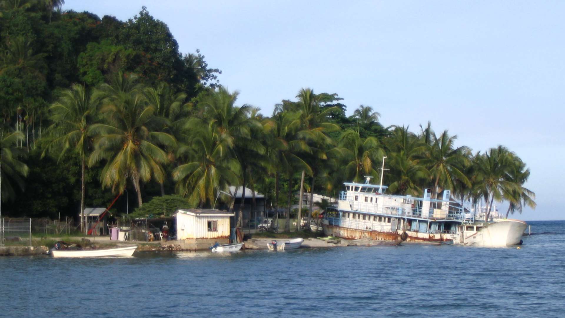
Photo by David Bacon, via Wikimedia Commons (CC BY 2.0)
Passam Junction and the Sepik Highway
Near Wewak, the route reaches an important choice. One road continues toward Wewak itself on the coast, while another turns inland toward the Sepik Highway and Angoram. On the map these seem to offer two different strategies: staying near the Pacific coast, or entering the Sepik Basin.
In reality, both are shaped by the same geography. The coastal route and the inland road both lead toward the vast lowland world of the Sepik, where rivers, floodplains and wetlands begin to dominate movement. The road network may divide, but the terrain problem does not.
This is also where Papua New Guinea’s road future becomes important. The Passam Junction–Angoram section has become a major infrastructure priority under national road-building programmes, and road improvements are gradually strengthening access into East Sepik. That does not yet create a confirmed through-road to the North Coast Highway farther east, but it shows that this region is increasingly recognised as one of the country’s strategic missing links. For the present expedition, however, Angoram still marks the practical limit of continuous road movement.
The Sepik River Changes Everything
The Central Highlands were the great mountain barrier of New Guinea. The Sepik River presents a completely different problem.
Here the obstacle is not steep terrain, but water spread across an enormous lowland basin. The Sepik and its tributaries form a landscape of rivers, swamps, floodplains and seasonally flooded forest. In such terrain, building and maintaining a long-distance road can be as difficult as constructing one through the mountains.
The Sepik Highway reaches Angoram, one of the last major road-accessible settlements in this part of the basin. Beyond it, the road no longer provides a reliable eastbound corridor toward the next major road system. This may change in the future. Papua New Guinea’s national road plans increasingly point toward better east-west connectivity, and a future link between the Sepik and the North Coast Highway is geographically logical. But at present, no confirmed continuous through-road exists across the Sepik–Ramu gap.
For the expedition traveller, this is the first true break in the route since leaving Sorong. The vehicle has crossed Indonesian New Guinea, entered Papua New Guinea and reached deep into the Sepik Basin. Then the road logic changes. From here, rivers, boats, coastal walking and local knowledge become more important than the vehicle itself.
New Guinea does not present one single barrier. It presents a sequence of barriers, each with a different form. First came the mountains. Now come the rivers.
Beyond the Sepik: Rebuilding the Route
Reaching Angoram does not necessarily mark the end of a west-to-east crossing of New Guinea.
It marks the point where a continuous road once again gives way to a different transport system.
Unlike the Central Highlands, where engineering has gradually created a through-road, the Sepik–Ramu lowlands still require the traveller to combine roads, rivers, local boats and short overland sections. The route continues, but no longer as a conventional road journey.
This situation is unlikely to remain permanent. Papua New Guinea’s current infrastructure programmes increasingly identify east-west connectivity as a national priority, making this one of the most likely sections of the island to change in the future. For the present, however, the expedition must adapt to the geography that exists today rather than the roads that may exist tomorrow.
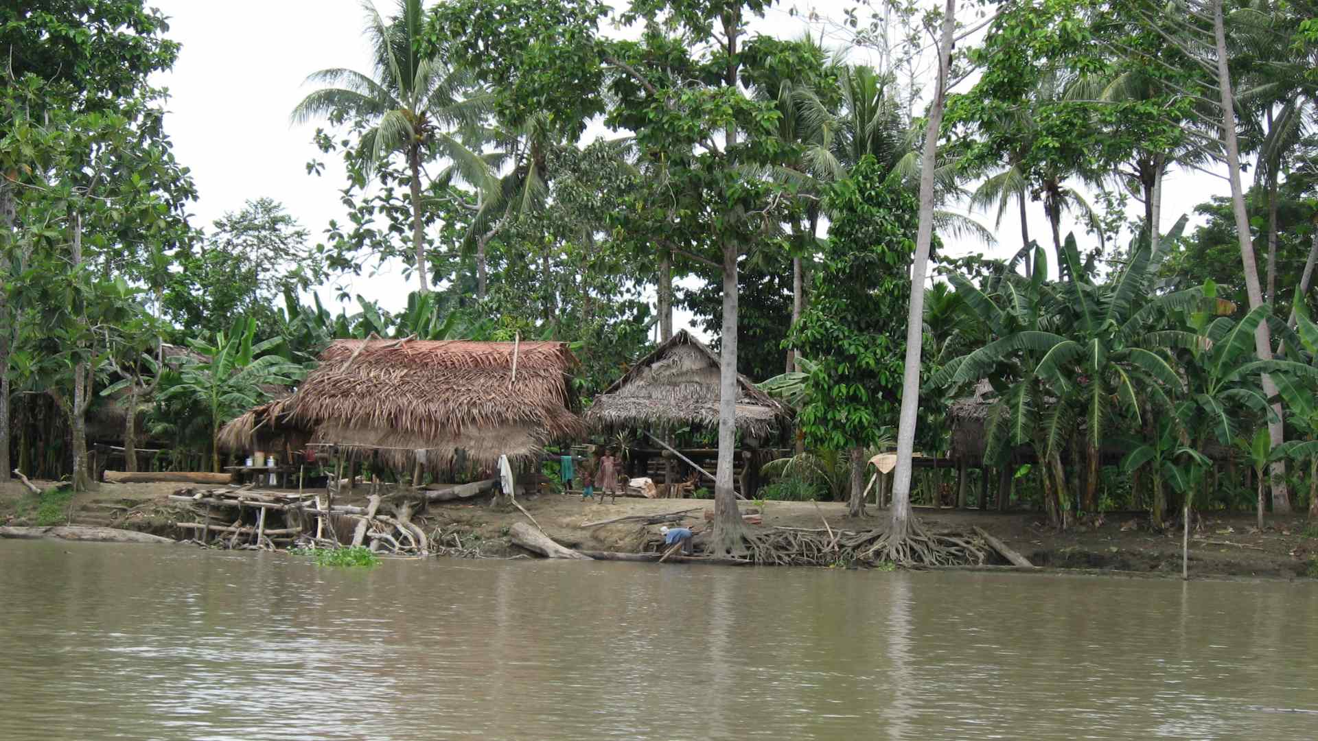
Photo by David Bacon, via Wikimedia Commons (CC BY 2.0)
From the Sepik toward the Ramu
The most obvious idea might seem to be leaving the Sepik somewhere upstream and crossing directly toward the Ramu Basin. On a map, the distance between the two river systems appears surprisingly small. On the ground, however, this is probably the most difficult option.
The Sepik and Ramu belong to different drainage basins. Between them lies a broad belt of swamp forest, numerous tributaries and low tropical rainforest with virtually no continuous transport infrastructure. Satellite imagery shows scattered settlements along rivers such as the Bien and Keram, but no road network linking the two basins. There may be local footpaths between neighbouring villages, yet crossing the entire region would almost certainly become a demanding jungle expedition rather than a practical transport corridor. A more realistic continuation follows the coast.
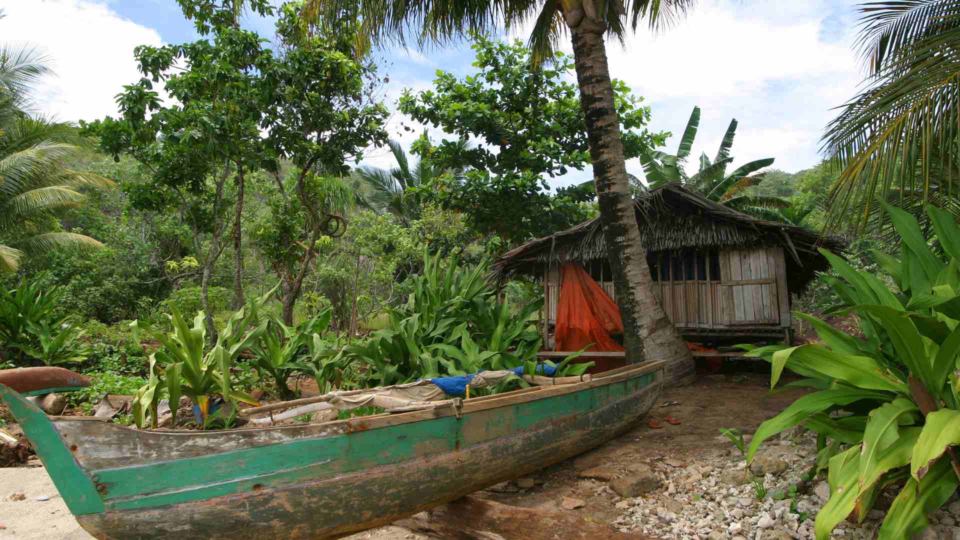
From Angoram, local river boats can carry the expedition downstream along the Sepik toward its mouth. Near Watam, historical accounts and modern mapping suggest that the coastline becomes passable on foot for a short distance, allowing the route to continue along the narrow beach toward Marangis. The Ramu estuary then forms the final major obstacle. Local boats are likely to provide the most practical crossing, although this depends entirely on local conditions and available transport at the time.
Beyond the estuary, two geographical options emerge. The shorter option reaches Botbot, where the western end of the North Coast Highway begins. Although modest compared with the better-developed sections farther east, it restores continuous road travel across the northern coast.
An alternative is to continue upstream along the Ramu by boat before leaving the river near Bunapak and joining local roads toward Nubia Junction. This increases the river component of the journey but may reduce the need for coastal walking.
Neither option represents a verified expedition route. Both are geographical reconstructions based on current mapping, satellite imagery and known local transport patterns. Any real expedition would require local verification and considerable flexibility.
Reaching the North Coast Highway
Eventually, the expedition reconnects with New Guinea’s next major road system. Whether that happens near Botbot or farther inland around Nubia Junction, the result is essentially the same. After days of combining roads, rivers, village boats and short coastal crossings, continuous road travel begins once again.
This moment represents another important turning point. The North Coast Highway follows the coastline toward Madang and eventually Lae, providing the longest uninterrupted road corridor remaining in Papua New Guinea. For the first time since leaving the Sepik Basin, the expedition can once again rely primarily on a conventional road network.
The contrast with the previous section is striking. Only a short distance to the west, rivers had replaced roads as the principal transport corridors. Here, the balance shifts once more in favour of wheeled transport. This pattern captures the geography of New Guinea remarkably well. Roads appear, disappear and reappear—not randomly, but wherever the landscape allows them.
Although no confirmed road yet connects the Sepik Highway directly with the North Coast Highway, the missing link has become increasingly significant within Papua New Guinea’s long-term infrastructure planning. If such a connection is eventually completed, the principal interruption in the island’s road network would shift farther east. Until then, the Sepik–Ramu transition remains the defining logistical challenge of a west-to-east crossing.
The North Coast Highway
After the complex transition between the Sepik and Ramu river systems, the character of the expedition changes once again. Whether the route rejoins the road network near Botbot or farther inland around Nubia Junction, the result is the same: continuous road travel becomes possible again.
From here, the North Coast Highway follows Papua New Guinea’s northern coastline through Bogia and Madang before continuing southeast toward Lae. Compared with the fragmented transport systems encountered farther west, this is one of the island’s most dependable long-distance road corridors. Rivers still require bridges, mountain slopes still demand careful engineering, and weather continues to influence travel, but the fundamental question of route continuity has finally been answered.
For an expedition crossing New Guinea from west to east, reaching the North Coast Highway is one of the defining milestones of the entire journey. After days of adapting to rivers, boats and coastal walking, the expedition once again becomes primarily an overland journey.
Madang
Madang is one of Papua New Guinea’s principal coastal cities and one of the country’s most important transport hubs. Its harbour, airport and road connections link the remote northwestern provinces with the larger urban centres farther southeast.
For an overland expedition, however, Madang represents more than a major city.
It is the point where the logistical balance begins to change again.
From here, continuous driving becomes possible once more, but Madang also marks the place where future expedition strategies begin to diverge. Some journeys naturally continue toward Port Moresby and conclude the crossing of New Guinea. Others turn their attention toward the islands of Melanesia, where roads gradually give way to ferries, local boats and eventually open-sea navigation.
Lae
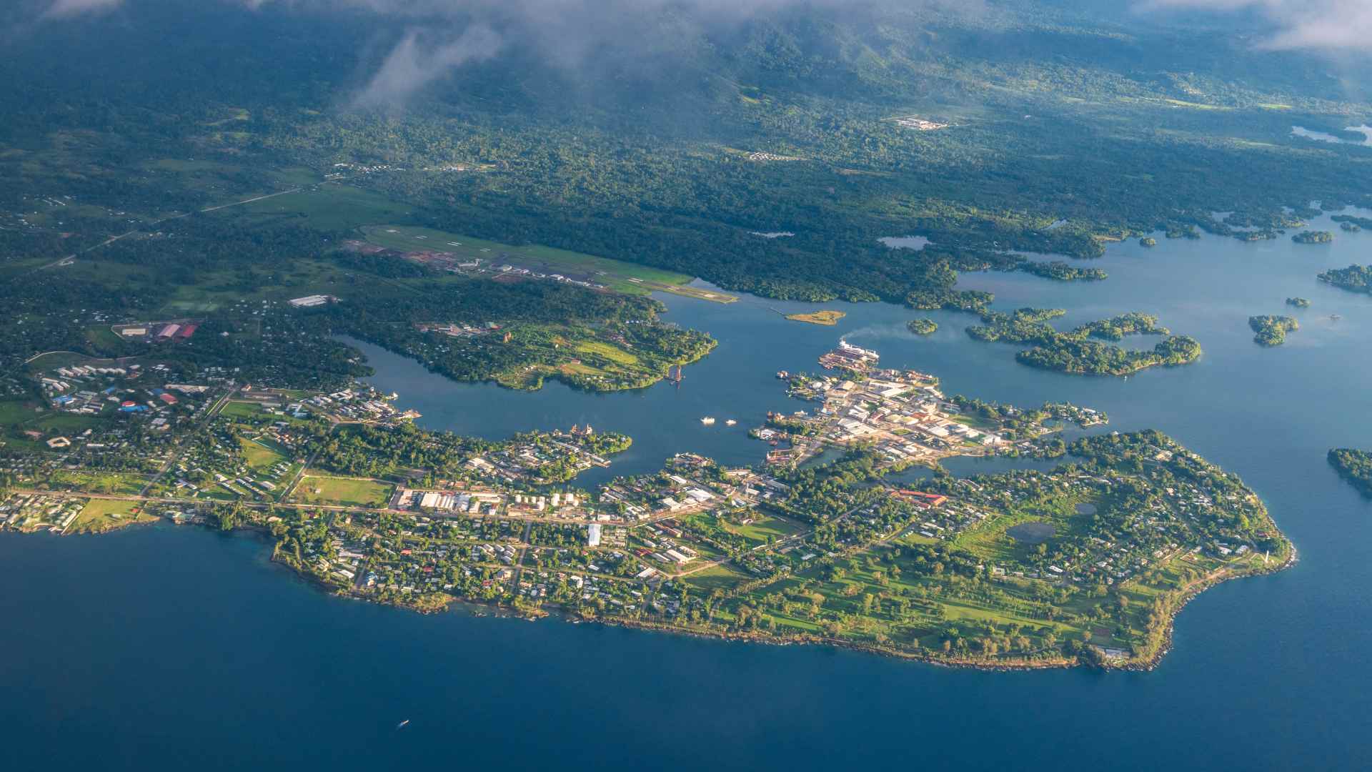
Farther southeast, the North Coast Highway reaches Lae, Papua New Guinea’s second-largest city and its principal industrial and logistics centre.
Lae is home to the country’s busiest cargo port and forms the main connection between the northern coast, the Highlands and international shipping. It is also the point where New Guinea changes character once again. The geography no longer dominates every decision. Instead, ports, shipping schedules and regional transport connections begin to shape the next stage of the expedition.
For travellers whose objective is simply to cross New Guinea, Lae represents one of the island’s most natural finishing points. For others, it becomes the gateway to the wider island world lying farther east.
Why the Highlands Highway Does Not Solve the Problem
Just west of Lae, near Watarais, another major road branches inland. This is the Highlands Highway, Papua New Guinea’s principal internal road, linking Lae with Goroka, Kundiawa and Mount Hagen.
At first glance, this raises an obvious question. If such an important highway reaches deep into the mountains, could the expedition simply have approached Lae through the Highlands instead of negotiating the difficult Sepik–Ramu transition? The answer is no.
The Highlands Highway was designed to connect Papua New Guinea’s densely populated mountain provinces with the coast. It is not a west-to-east corridor across the island. Beyond Mount Hagen, the road network gradually fragments into shorter regional roads before giving way to rugged mountain terrain with no continuous connection toward Indonesian New Guinea.
In other words, the Highlands Highway does not bypass the Sepik–Ramu gap. It begins far to the east of it. An expedition approaching from Indonesia would still have to overcome the missing western connection before ever reaching Mount Hagen. The Highlands Highway therefore cannot replace the Sepik route; it simply serves a different geographical purpose within Papua New Guinea’s transport network.
Choosing the Eastern Exit from New Guinea
After crossing New Guinea, one important geographical decision still remains.
Unlike many large islands, New Guinea does not have one obvious eastern endpoint. The most logical place to leave the island depends not on New Guinea itself, but on the direction of the expedition that follows.
For some travellers, reaching Papua New Guinea’s capital represents the natural conclusion of the journey. For others, New Guinea is only one stage of a much longer route through Melanesia and Oceania.
The island therefore offers not one ending, but two.
Lae: The Natural Continuation toward Melanesia
For expeditions continuing eastward through Oceania, Lae provides the most logical departure point.
As Papua New Guinea’s principal northern port, it connects naturally with the Bismarck Archipelago. From there, the route can continue through New Britain, New Ireland and Bougainville before eventually reaching the Solomon Islands.
Although repeated sea crossings become unavoidable, they remain relatively short and follow the natural chain of Melanesian islands. Geographically, this preserves as much continuity as the region allows. Instead of making one major leap across open ocean, the expedition progresses gradually from one island group to the next.
For a long-distance journey extending toward the Pacific, this is the most coherent continuation of the route.
Port Moresby: Completing the Island
Port Moresby serves a different purpose.
For travellers whose primary objective is simply to cross New Guinea, continuing south to the national capital provides a satisfying conclusion. With the gradual expansion of Papua New Guinea’s road network, reaching Port Moresby is becoming increasingly realistic and now represents the most complete road-based finish to the island crossing.
Beyond Port Moresby, however, the geographical logic changes.
Continuing east toward the Louisiade Archipelago and the Solomon Islands remains possible, but no longer follows the natural sequence of larger Melanesian islands. Instead, longer sea passages and more specialised maritime transport become increasingly important, making this a much less straightforward continuation than the northern route through the Bismarck Archipelago.
For that reason, Port Moresby is best understood as the natural end of a New Guinea crossing rather than the beginning of a wider island-hopping expedition.
Two Different Endings
Neither exit is universally better. Each serves a different expedition objective.
Lae naturally connects New Guinea with the island chains of Melanesia, making it the more logical choice for routes continuing east across Oceania.
Port Moresby, by contrast, represents the most complete conclusion to the crossing of New Guinea itself, bringing the expedition to the country’s political and administrative centre.
In other words, the eastern exit from New Guinea is determined not by the island, but by what lies beyond it.
Practical Expedition Questions
After analysing New Guinea’s geography and transport systems, the remaining question is no longer whether the island can be crossed, but how such a crossing can be organised in practice. Because much of New Guinea involves remote regions, limited infrastructure and changing transport conditions, comprehensive expedition travel insurance is worth considering before attempting such a journey.
There is no single correct solution. The most appropriate strategy depends entirely on the objective of the expedition. Some travellers simply want to complete the crossing of New Guinea itself. Others intend to continue eastward through Melanesia and eventually into Oceania. Those different goals naturally lead to different logistical choices.
Scenario 1 — Completing New Guinea by Vehicle
For an expedition ending in Papua New Guinea, the vehicle remains the most practical means of transport for almost the entire journey.
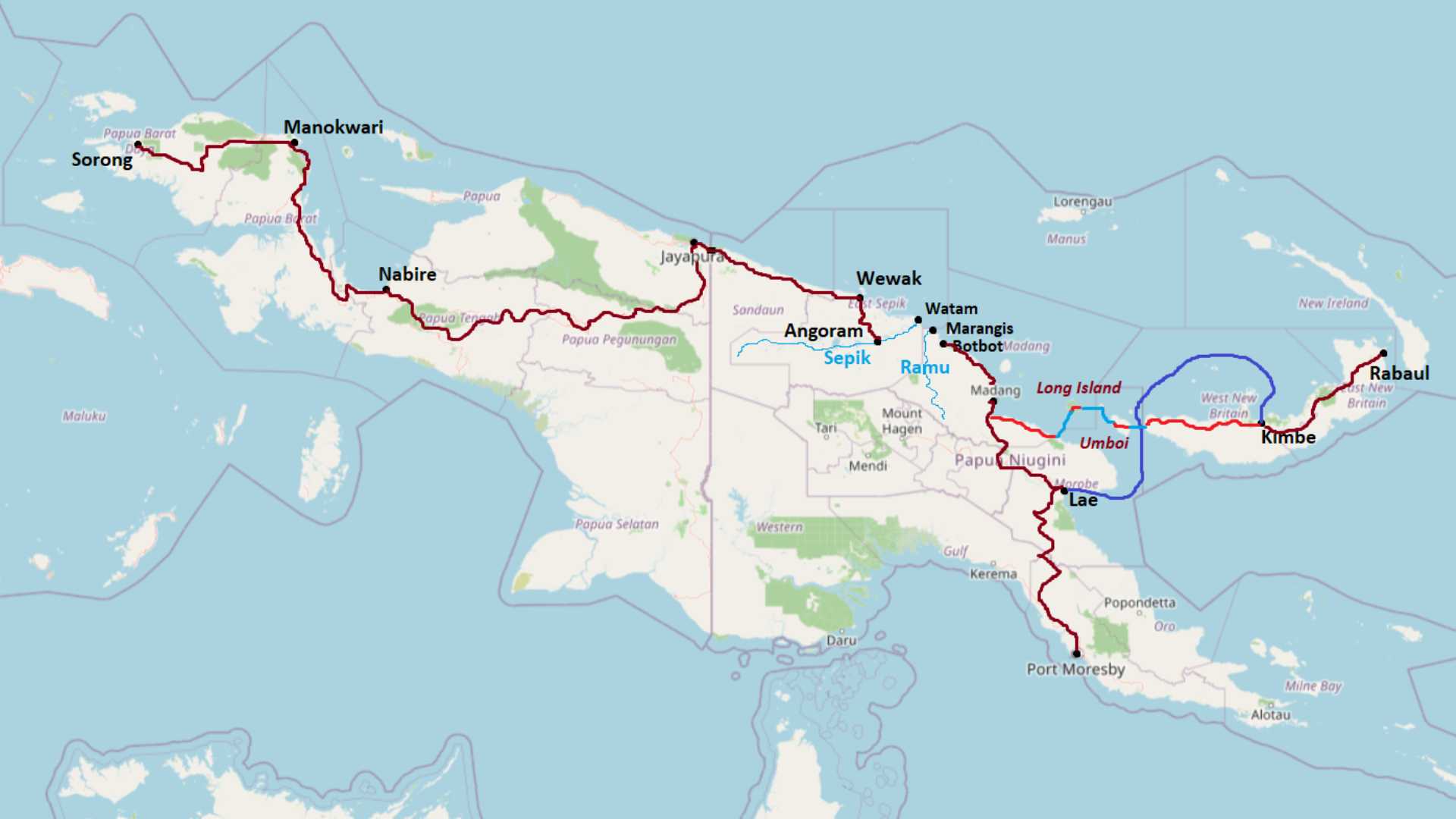
After arriving in Sorong, the expedition follows the Trans-Papua Highway across Indonesian New Guinea before continuing through Vanimo and Wewak. At this point, however, the Sepik–Ramu gap interrupts continuous road travel.
Rather than attempting to force the vehicle through terrain where no verified through-road currently exists, it becomes more practical to separate the expedition from the vehicle temporarily. The vehicle can be shipped by coastal cargo from Wewak to Madang while the expedition continues independently using a bicycle and packraft.
From Wewak, the route follows local roads toward Angoram before transferring onto the Sepik River. Small local boats replace roads through the lower basin, followed by a combination of river travel, short coastal walking near Watam and Marangis, and another local boat across the Ramu estuary before reaching the North Coast Highway near Botbot or Nubia Junction.
Once the expedition reaches Madang, it reunites with the vehicle and continues overland toward Port Moresby via the Highlands Highway connection. For travellers whose objective is simply to cross New Guinea, this provides a logical conclusion. The vehicle can then be shipped home while the expedition members return by air.
Scenario 2 — Continuing toward Melanesia
If New Guinea is only one stage of a much longer expedition, the role of the vehicle changes completely.
Although a car is highly effective across New Guinea, every island farther east requires another cargo shipment, another unloading operation and another customs procedure. Gradually, the vehicle becomes more of a logistical burden than an advantage.
In this scenario, the vehicle remains in Papua New Guinea while the expedition continues with a bicycle and packraft. These are light enough to travel on ferries, local boats and village transport while remaining practical on roads, tracks and occasional off-road sections.
From Madang or Lae, the journey continues by domestic ferry to New Britain before crossing the island toward Kimbe and Rabaul. The same transport pattern can then continue across Bougainville and the larger islands of Melanesia, where ferries or local shipping connect the islands and bicycles reconnect the land sections between ports.
Here, the expedition gradually transforms from a continental overland journey into an island-hopping expedition.
Scenario 3 — Maximum Geographical Continuity
For travellers whose primary objective is geographical continuity rather than logistical simplicity, an even more ambitious alternative becomes possible.
Instead of boarding a direct ferry from the New Guinea mainland to New Britain, the expedition follows the natural chain of offshore islands.
After reaching Madang, the route continues by bicycle toward Gali, where local boats provide the crossing to Long Island.
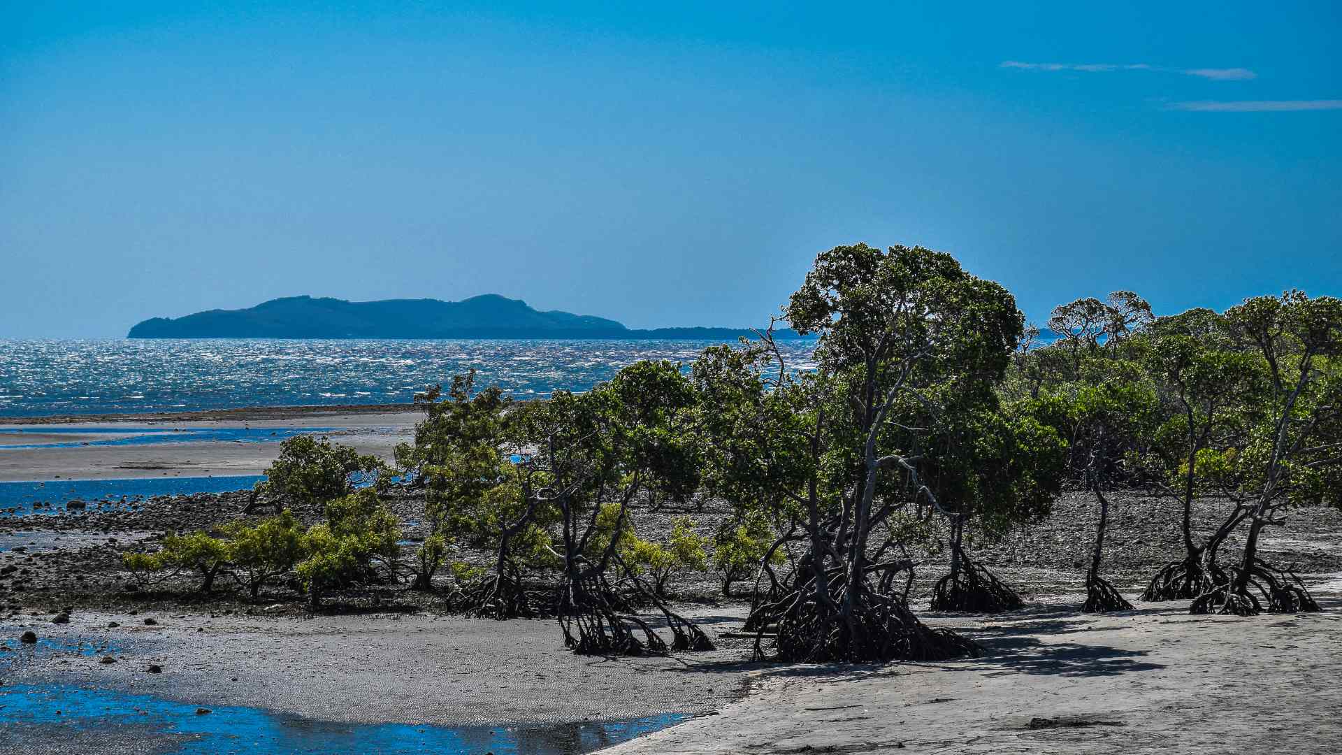
Rather than remaining on the coast, Long Island itself becomes part of the expedition. The route climbs into the volcanic interior, reaches Wisdom Lake and continues toward Bok on the opposite coast. A packraft allows the lake itself to become part of the crossing, while bicycles can be transported with the assistance of local villagers whenever necessary. Depending on conditions, an overnight camp beside the lake may become part of the journey.
From Bok, another locally arranged boat reaches Tolokiwa Island. Because the island is both small and steep, it is probably more practical to leave the bicycle temporarily with local residents, explore the island on foot, then return before continuing to Umboi.
On Umboi, rough but usable roads once again become the principal transport corridor. After crossing the island toward Marile, another local boat reaches the western coast of New Britain, where overland travel resumes toward Kimbe and Rabaul.
Unlike regular ferry routes, this scenario attempts to follow the geography itself rather than simply connecting ports. Local boats are not booked through fixed schedules but arranged directly with village boat owners. Waiting for suitable weather or available transport becomes part of the expedition rather than an interruption to it.
Scenario 4 — The Floating Garage
The final scenario represents the most ambitious and resource-intensive approach.
Instead of leaving the vehicle behind, the expedition is supported by a landing-capable yacht acting simultaneously as transport vessel, floating garage, workshop and supply base.
While the land team crosses each island, the yacht sails around the coastline to the next agreed landing point, carrying the vehicle together with spare parts, fuel, food and heavier equipment.
This preserves the vehicle far beyond New Guinea and greatly reduces dependence on local transport, but it also transforms an overland expedition into a coordinated land-and-sea operation requiring a permanent crew, careful planning and a substantial budget.
Even this solution has limitations. The yacht cannot always follow the exact land route, while many island roads remain rough, muddy and seasonally damaged. Any vehicle used in such an expedition must therefore be capable of sustained travel on difficult unsealed roads rather than ordinary highways.
Although this is the most capable logistical solution, it is also by far the most expensive and operationally demanding.
Planning Beyond New Guinea
Perhaps the most important lesson of New Guinea has little to do with roads themselves.
The island marks the point where a continental expedition gradually transforms into an island expedition.
West of New Guinea, progress is shaped primarily by roads, mountain ranges and international borders. East of it, rivers begin replacing roads, coastal boats replace bridges, and island chains gradually replace continuous land.
For that reason, logistical decisions made in New Guinea should never be considered in isolation. Choosing whether to keep a vehicle, switch to a bicycle, carry a packraft or organise maritime support depends not only on New Guinea itself, but also on the character of the expedition that follows.
An expedition ending in Port Moresby is fundamentally different from one continuing through New Britain, Bougainville and the Solomon Islands. Beyond Papua New Guinea begins an entirely different geographical world whose transport logic deserves its own separate analysis.
In many ways, that transition is New Guinea’s greatest geographical lesson. It is not simply an island to be crossed, but the place where overland travel gradually evolves into exploration across the islands of the Pacific.
Conclusion
At first glance, New Guinea appears to be one of the world’s last great overland obstacles. Mountains, rainforest, immense river systems and political boundaries suggest an island where movement simply comes to an end.
The reality is far more complex. New Guinea is not a roadless island. Neither is it a fully connected one.
Instead, it is an island where different transport systems repeatedly replace one another. Roads become rivers, rivers become coastal navigation, and overland travel gradually evolves into island travel. The challenge is not simply finding a road, but recognising when one mode of movement gives way to another.
Even this reality is not static. Roads continue to expand, missing links are gradually being closed, and the island’s transport geography is still evolving. The obstacles remain, but the places where they must be overcome continue to change.
For some travellers, Port Moresby marks the successful end of one of the world’s most demanding island crossings. For others, New Guinea is only the threshold to a new geographical world, where continents give way to archipelagos and overland travel gradually becomes oceanic expedition travel.
Perhaps nowhere else on Earth illustrates that transition more clearly than New Guinea itself.
Like it? Pin it here⇓! Follow us on Facebook, X and Instagram!
You may also like



Hi, we are Krasen and Ying Ying. Krasen is from Bulgaria, and Ying Ying is from China. We are passionate about geography and history, and we believe that the best way to experience it is by exploring the Earth in reality, not in a school, and not virtually.
So, we created this blog Journey Beyond the Horizon, where we share geographical knowledge, travel guides and tips how to experience it when you explore our planet, and a lot of inspiration.
And we wish you a happy journey, not just virtually, but most of all- in reality.
Enjoy!
Krasen and Ying Ying
Hi, we are Krasen and Ying Ying. Krasen is from Bulgaria, and Ying Ying is from China. We are passionate about geography and history, and we believe that the best way to experience it is by exploring the Earth in reality, not in a school, and not virtually. So, we created this blog Journey Beyond the Horizon, where we share geographical knowledge, travel guides and tips how to experience it when you explore our planet, and a lot of inspiration. And we wish you a happy journey, not just virtually, but most of all- in reality. Enjoy!

