
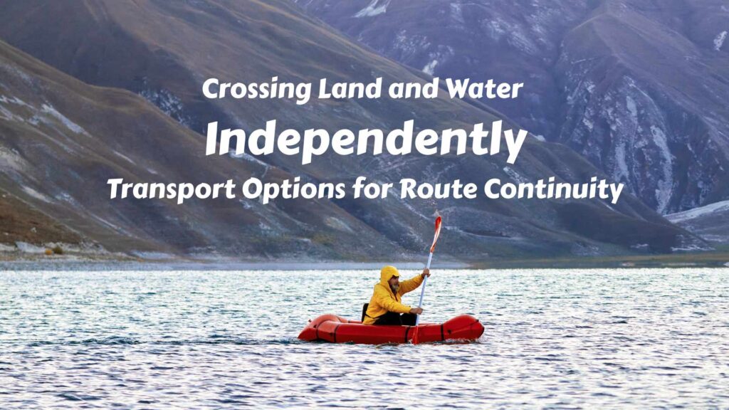
Most long-distance routes are still imagined as movement across land: roads, trails, deserts, mountains, forests and borders. But the Earth’s surface is not only land. Rivers, lakes, wetlands, fjords, straits, seas and archipelagos constantly interrupt the line of movement.
For a traveler who wants to follow geography, water does not always have to be the end of the route. Sometimes it is the next surface of movement. The real question is how to continue when the route changes from land to water — and back to land again. This question becomes especially important in long-distance routes, where the line of movement has to remain meaningful across roads, trails, rivers, coasts, islands and sea gaps.
This article is not a technical sailing, kayaking or packrafting manual. It is a route-planning framework for understanding how boats, packrafts and other water-based tools can help preserve route continuity across both land and water. For the broader preparation process before transport details become this specific, see the general guide to preparing travel plans.
Table of Contents
The Earth’s Surface Has Two Main Travel Surfaces: Land and Water
For route planning, the Earth’s surface can be simplified into two main travel surfaces: land and water. The distinction sounds obvious, but it becomes important when a route has to remain continuous across both.
Land is useful only when the terrain allows movement, or when infrastructure turns it into a route. A paved road, a mountain trail, a desert plain, a glacier, a forest, a steppe, a tundra, a swampy taiga and a rocky coastline are all “land”, but they do not offer the same movement possibilities. Some can be crossed easily. Others require a specific season, equipment, local knowledge or vehicle support.
Water is just as varied. A narrow river, a wide river, a lake, a delta, a fjord, a strait, a sheltered sea, an archipelago channel and an open ocean all create different route problems. Some can be crossed in minutes. Others require a ferry, sea kayak, motorboat, sailing boat, packraft, or a full maritime expedition.
Between land and water there are also transition zones: wetlands, mangrove coasts, marshes, river deltas, shallow channels, mudflats, tidal zones and small streams that may be easy in one season and serious obstacles in another. These places matter because the boundary between land and water is not always a clean line on the map.
For independent route planning, the key point is not simply whether a surface is land or water. The key point is what kind of movement each surface allows, and whether the traveler can change movement mode when the route reaches the next surface.
Moving Across Land: Roads, Trails and Terrain Resistance
Land movement is simple only where terrain and infrastructure support it. A road turns distance into a route. A trail turns rough terrain into a line of movement. Without either of them, the same land can become slow, uncertain or impossible to cross.
The important difference is not only between “easy” and “difficult” terrain, but between surfaces that allow continuous movement and surfaces that break it. A plain with roads, a desert without water, a forest without visibility, a glacier with crevasses, a mountain range crossed only by passes, a tundra bog that is firm only in winter — all of them are land, but they do not offer the same kind of route.
This is why land transport is always conditional. A car depends on roads or tracks. A motorcycle can continue farther, but still needs a usable surface. A bicycle is flexible, but slow when the terrain becomes rough. Walking is the most universal form of land movement, but also the slowest. Skis, snowshoes, pack animals, sleds or 4×4 vehicles are not just “alternative transport”; they are responses to specific terrain conditions.
For a surface-based journey, land is not simply the part of the route before the water begins. It has its own resistance, gaps and transitions. Roads end, tracks dissolve, snow creates temporary corridors, swamps erase firm ground, and mountains force movement through limited gates. Long before a route reaches a river, lake or sea, the land itself may already be changing the rules of movement.
Moving Across Water: Rivers, Lakes, Coasts, Seas and Oceans
Water is often treated as the interruption in a land route, but it is not one kind of surface. A narrow river, a large lake, a sheltered bay, an archipelago channel, a tidal coast, an open sea and an ocean crossing all create different movement problems.
Rivers
On rivers, movement follows current, bends, rapids, waterfalls, banks and seasonal water levels. A river can block a land route, but it can also become the easiest line through a forest, a mountain valley, a swampy plain or a roadless interior. The practical question is whether the watercourse supports movement, interrupts it, or forces the traveler to move only in one direction.
Lakes
Lakes and inland waters create another kind of route problem. A small lake may be crossed quickly with a packraft or kayak. A large lake can behave almost like a small sea, with wind, waves, exposure and no easy exit once the crossing has begun. In lake districts, wetlands and northern taiga, water may not appear as one clear barrier, but as a fragmented surface of lakes, channels, marshes and flooded ground.
Large bodies of water
Coasts, seas and oceans change the scale again. Along a protected coast, water can become a corridor between bays, islands, fjords and peninsulas. In open sea, the route becomes dependent on weather windows, navigation, currents, tides, ports, landing places and the seaworthiness of the boat. The farther the route moves away from shelter, the less it resembles a simple crossing and the more it becomes a maritime expedition. For larger sea crossings and ocean passages, this becomes the separate problem of independent sea travel by boat, where the route depends not only on the water gap itself, but also on vessel capability, legal entry points, maritime zones, weather windows, costs, safety and life on board.
For independent surface travel, the key is not only whether water is present, but what kind of water it is. Some water can be crossed, some can be followed, some must be avoided, and some requires a completely different transport system. A packraft, canoe, kayak, ferry, motorboat and sailing boat are not interchangeable tools. Each one works only when the water surface, distance, weather and legal conditions allow it.
The most difficult point is often not the land itself or the water itself, but the place where one movement system has to change into another.
The Shoreline: Where the Route Changes Its Rules
The shoreline is not only a line on the map. For route planning, it is the transition point where one movement system stops being useful and another one has to begin.
On one side, movement may depend on roads, trails, wheels, walking, animals or snow routes. On the other side, it may depend on paddles, motors, sails, ferries, currents, tides, waves, landing places or ports. The geographic route may continue naturally, but the transport method may no longer fit the surface.
This boundary is not always clear. A rocky coast, a sandy beach and a riverbank can create a visible edge between land and water. But in wetlands, marshes, mangrove coasts, deltas, tidal flats, flooded forests and swampy taiga, land and water mix into one unstable surface. The traveler is no longer dealing with a simple crossing, but with a zone where walking, driving, floating and carrying gear may all become difficult at the same time. Where these transitions occur in tropical environments, the complete system of gear for hot, wet and roadless terrain must protect critical items from moisture while remaining light, accessible and transferable between walking and water travel.
This is why the shoreline is often the real test of route continuity. The question is not only how to cross the water, but how to move from one surface system into another without breaking the journey.
Can One Vehicle Move Across Both Land and Water?
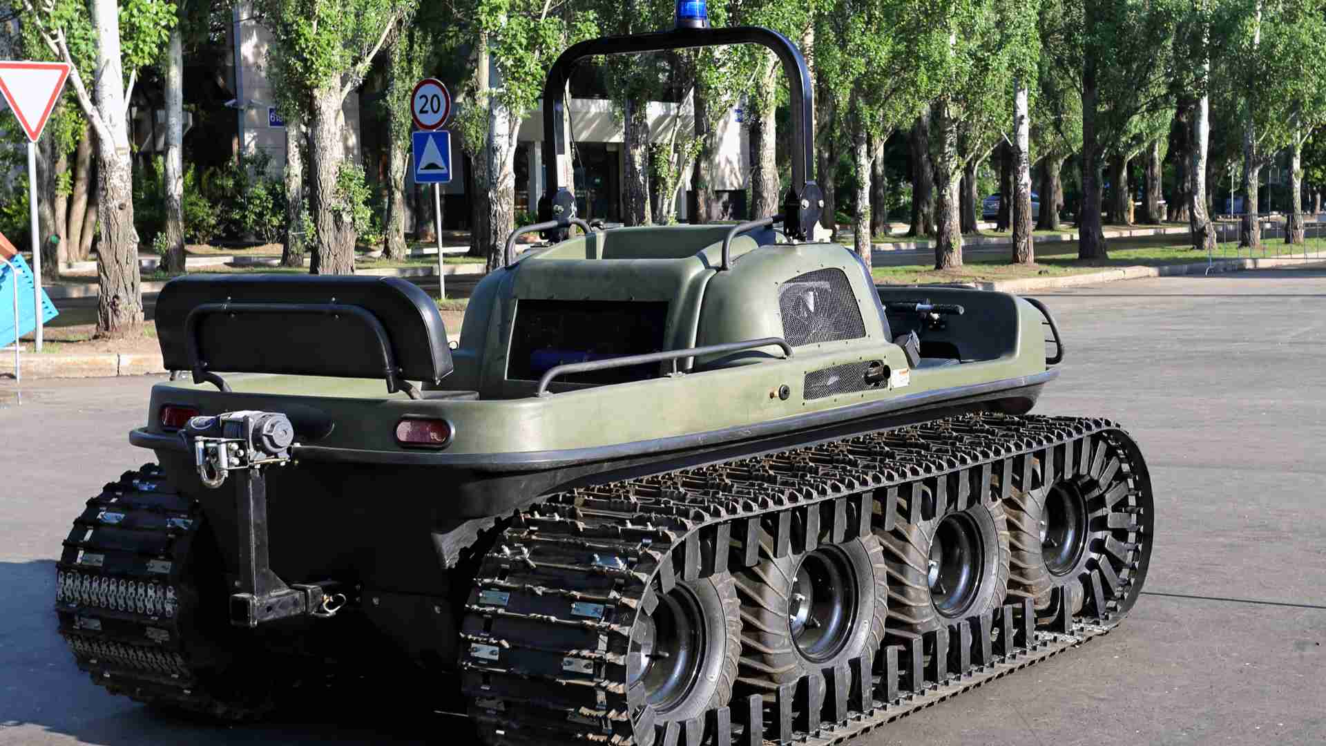
The simplest solution would be one vehicle that can move across both land and water without changing transport mode. Such vehicles exist. They are usually called amphibious vehicles, amphibious ATVs, amphibious all-terrain vehicles, or amphibious expedition machines.
Examples include small amphibious XTVs such as ARGO 6×6 and 8×8 vehicles, extreme off-road machines such as SHERP, and high-speed amphibious concepts such as the Gibbs Quadski, Terraquad or Aquada. These machines prove that the idea is real: a vehicle can be designed to drive on land, enter water, float, move across it, and return to land again.
Amphibious vehicle’s limitations
They also show the limit of the idea. An amphibious vehicle is usually a compromise. On land, it is often slower, heavier and less efficient than a normal road vehicle. On water, it is usually slower and less seaworthy than a real boat. Many amphibious all-terrain vehicles can cross calm water, marshes, flooded ground or small lakes, but they are not designed for open seas, strong currents, large waves or long maritime passages.
Their strongest terrain is the transition zone itself: places where ordinary cars cannot drive, ordinary boats cannot reach easily, and walking becomes too slow or exhausting. In this kind of landscape, an amphibious vehicle can be extremely useful — taiga, tundra, wetlands, shallow rivers, peatlands, flooded plains, snow, mud and mixed land-water terrain.
However, the same vehicle creates new problems. It may not be legal on public roads. It may need registration or permission if used on water. And it may be difficult to transport between countries. Repairs can become serious if the machine breaks far from roads or settlements. Fuel, spare parts, rescue, insurance and local regulations all become part of the expedition system.
For this reason, amphibious vehicles are best understood as specialized tools for specific land-water environments, not as universal machines for crossing every surface on Earth. They can push the limit of independent movement deeper into swamps, tundra and river-taiga landscapes, but they do not remove geography. They only change where the next limit appears.
Different Combinations of Land and Water Transport
If an amphibious vehicle cannot solve every land-water problem, the next solution is not to search for one perfect machine. It is to combine different movement systems. This is one part of the wider transport-planning problem in overland routes and expedition travel, where the route often depends on combining several movement systems rather than choosing only one.
This is the core of independent land-water travel. The traveler does not remove the boundary between land and water. Instead, the traveler manages the transition: wheels or feet on land, floating or paddling on water, then wheels or feet again after landing.
The more water transport you can carry yourself, the more independent the route remains. The larger and heavier the watercraft becomes, the more the journey depends on external logistics: trailers, ports, ferries, cargo transport, local boats, storage, permits and other people.
Bicycle + Packraft: The Cleanest Combination
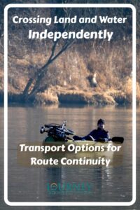
The cleanest land-water combination is probably the bicycle and packraft.
On land, the bicycle gives range, speed and efficiency. It can follow roads, gravel tracks, trails and open terrain more easily than a car or motorcycle in many remote areas. In the luggage, the traveler carries an inflatable packraft, paddle, life jacket, repair kit and dry bags. For the cycling side of this combination, see the broader guide to exploring the Earth by bike, including bike choice, cycling travel tips and biking gear.
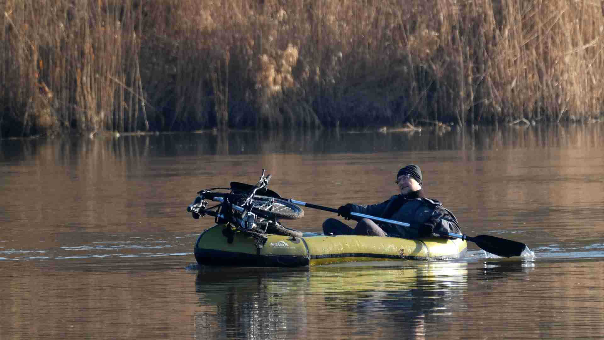
When the route reaches a river, lake, fjord or water gap, the system changes. The traveler stops, inflates the packraft, loads the bags and bicycle onto the boat, crosses or follows the water, lands on the other side, deflates the boat, packs it again and continues by bicycle.
This combination is powerful because the water transport belongs to the traveler. It does not require a ferry, port, trailer, marina or support vehicle. The route can continue across mixed terrain where land and water interrupt each other again and again.
But it is not unlimited. A packraft is slow and sensitive to wind, waves, cold water, strong current and bad weather. A loaded packraft carrying a bicycle is heavier and less agile than an empty one. It works best on rivers, lakes, sheltered coastal waters and short crossings, not on open seas or oceans.
So, bicycle + packraft is close to the purest form of independent land-water continuity, but only within the right scale. It is a tool for fragmented terrain, not for crossing the Atlantic.
Walking + Packraft: The Lightest Surface System
Walking with a packraft is even more minimal than bicycle + packraft. There is no vehicle, no wheels and no mechanical system to move forward. The traveler carries everything on the back: shelter, food, clothing, safety equipment, paddle, dry bags and the inflatable boat itself. The traveler carries everything on the back: shelter, food, clothing, safety equipment, paddle, dry bags and the inflatable boat itself.
This combination works best where the route repeatedly changes between land and water: mountain lakes, tundra, northern wilderness, river valleys, wetlands, fjords, taiga and remote landscapes with no continuous trail system. The packraft does not replace walking. It extends walking across surfaces that would otherwise stop the route.
The main advantage is freedom of transition. A walker can leave a trail, cross rough ground, reach a lake or river, inflate the packraft, continue by water, land again and keep moving on foot. There is no bicycle to load, no motorcycle to protect, no vehicle to leave behind, and no trailer or port infrastructure to depend on.
The hard limit is weight. The more food, clothing, safety equipment and water gear the traveler carries, the slower and heavier the land sections become. The journey may remain independent, but it becomes physically demanding.
Walking + packraft is therefore not a solution for fast travel or long open-water crossings. It is a surface-continuity tool for wild terrain where walking alone would be broken again and again by rivers, lakes, marshes or flooded ground.
Motorcycle + Inflatable Boat or Raft: Possible, but Difficult
A motorcycle extends land movement much farther than a bicycle. It can cover long distances quickly, follow rough roads and tracks, and carry more equipment than a bikepacking setup. But once the route reaches water, the motorcycle becomes a much heavier problem.
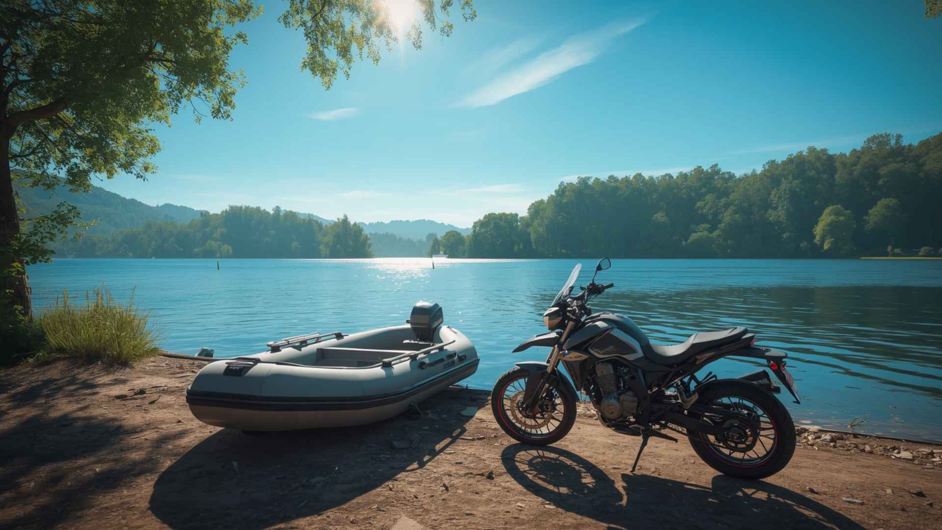
In theory, a motorcyclist can carry an inflatable boat or use a raft system for a river crossing. This may work for a short, specific obstacle: a calm river, a controlled crossing, a local raft, or an arranged boat transfer. But it is not a clean land-water system.
The problem is weight and risk. A motorcycle is heavy, awkward to load, and difficult to balance on a small inflatable craft. Fuel, oil, luggage and mechanical parts add more complications. If the bike falls into the water, the issue is no longer only transport continuity, but possible mechanical damage and loss of the whole route system.
This is why motorcycle + inflatable boat is better understood as an emergency or expedition technique, not a normal independent travel model. It can help overcome a specific water obstacle, but it does not create the same flexible transition as bicycle + packraft or walking + packraft.
For longer journeys, a motorcycle usually depends on bridges, ferries, local boats, cargo transport or carefully chosen crossing points. It gives strong freedom on land, but water quickly introduces external logistics.
Car or Van + Inflatable Boat, Kayak or Canoe
A car, van or 4×4 can carry a small inflatable boat, kayak, canoe or folding boat. This is a practical combination for travelers who want to use both road access and water access without turning the whole journey into a sailing expedition. For the wider advantages and limitations of car-based travel itself, see this guide to traveling the world by car.
On land, the vehicle carries people, luggage, camping gear and water equipment. When the route reaches a lake, river, reservoir, sheltered coast or island area, the boat becomes a second layer of movement. It can reach places that roads do not reach, cross short water gaps, explore shorelines, or continue into a river or lake system.
The limitation is clear: the vehicle usually stays on the shore. The traveler can continue by water, but the car or van cannot follow unless there is a ferry, barge or cargo option. This makes the setup useful for side branches, local exploration and return routes, but weaker for a continuous line where the whole transport system must move forward.
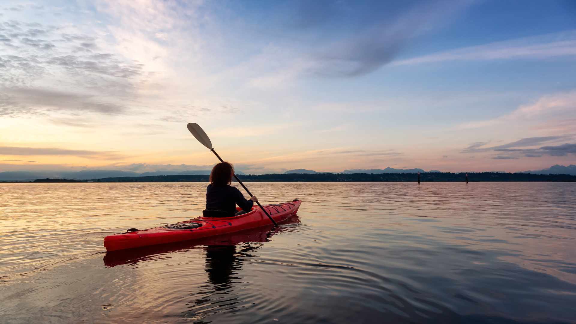
The type of watercraft also matters. An inflatable boat is compact and easy to carry, but slower and more vulnerable to wind and waves. A kayak or canoe can be more efficient on water, but harder to transport and launch. A folding boat may solve some storage problems, but still requires time, space and suitable access to the water.
So, car or van + small boat is a strong combination for reaching water from land. It is not, by itself, a complete solution for crossing from one land system into another. The traveler gains water mobility, but the land vehicle creates a return, storage or transfer problem as soon as the route continues beyond the far shore.
Car + Boat Trailer: More Capability, More Dependence
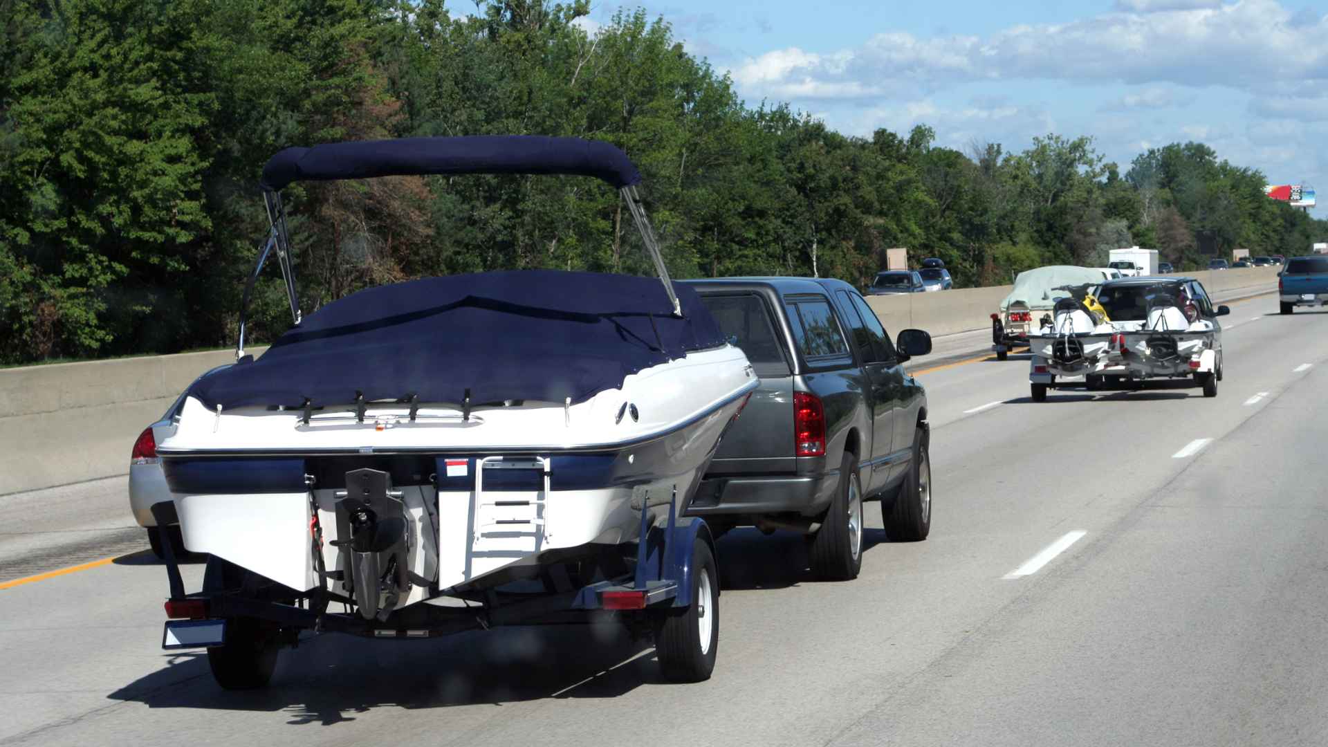
A larger boat can be carried by trailer. This gives the traveler more range, more stability and more carrying capacity on water than a small inflatable boat, kayak or canoe. It can work well for lakes, navigable rivers, protected coastal waters, island access and repeated water sections from a road-based route.
But a trailer changes the whole land system. The vehicle becomes longer, heavier and less flexible. Rough roads, narrow tracks, steep terrain, tight villages, border crossings, parking, ferries, fuel stops and launching places all become more complicated. The journey is no longer only about where the car can go, but also where the car can safely tow, store and launch the boat.
This setup works best where roads and boat ramps exist near the water. It is much weaker in wild terrain, swampy shores, rocky coasts, muddy riverbanks or remote places without proper access. A boat on a trailer gives more water capability, but it also makes the traveler more dependent on infrastructure.
It also does not solve the deeper continuity problem. The boat can move on water, but the car and trailer stay on land. The car can tow the boat across land, but the boat normally cannot carry the car across water. Unless there is a ferry, barge, landing craft or cargo system, the two transport modes remain connected only on one side of the shoreline.
So, car + boat trailer is a powerful local or regional system, but not a seamless land-water expedition solution. It increases capability, but also increases dependence on roads, ramps, storage, regulations and logistics.
Land Vehicle + Ferry: The Most Practical Bridge
For cars, motorcycles, bicycles and overland vehicles, the most practical way to cross many water gaps is still the ferry. It is not the most independent solution, but it is often the most realistic one.
A ferry keeps the transport system together. The traveler drives, rides or cycles onto the vessel, crosses the water, and continues on land after landing. The vehicle does not have to be abandoned, stored, dismantled or transferred separately. The water gap becomes a temporary interruption, not a complete break in the route.
This is why ferries are so important in archipelagos, fjord regions, straits, river crossings and coastal road systems. They allow land routes to continue through places where bridges do not exist and where private boats would be too complicated, too slow or unnecessary.
But a ferry is still external infrastructure. It exists only where there is a route, port, schedule, permission and demand. It may be seasonal, weather-dependent, expensive, limited to certain vehicle types, or closed by political, administrative or security conditions. In some remote regions, a ferry line on the map may operate only occasionally, or not at all when conditions change.
So, land vehicle + ferry is often the best practical bridge between land and water, but it is not full independence. The traveler keeps the vehicle, but depends on a public or commercial crossing system. For route continuity, this can be enough — as long as the ferry actually exists, accepts the vehicle, and operates when the traveler needs it.
Land Vehicle + Cargo, RoRo or Barge
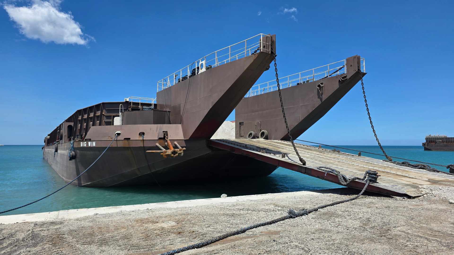
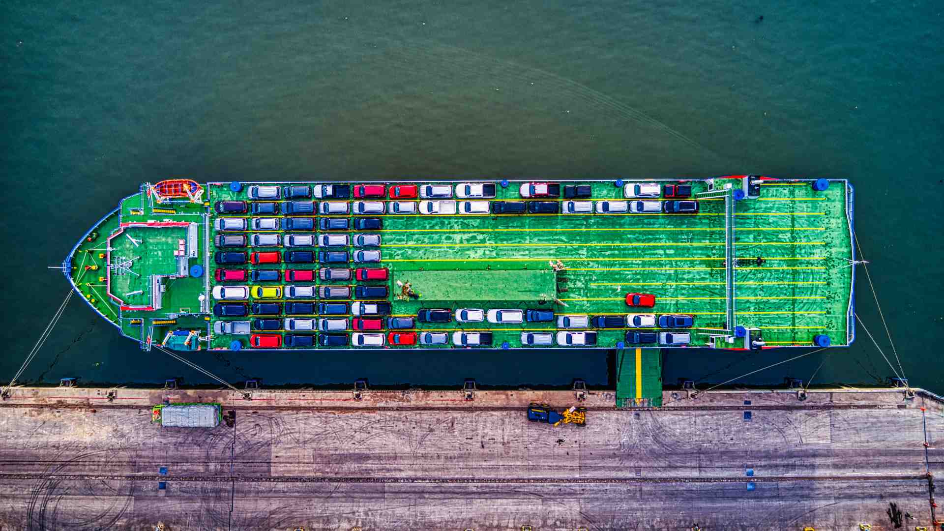
When there is no normal ferry, the next option is to move the vehicle as cargo. This can mean a RoRo ship, a river barge, a local cargo boat, a landing craft, container shipping, or another transport system that carries the vehicle across water.
This is no longer a simple continuation of the route. The vehicle stops being only a means of travel and becomes freight. The traveler has to deal with schedules, ports, loading procedures, customs, temporary import rules, insurance, documents, waiting time, cost and sometimes agents or shipping companies.
This kind of solution becomes important when the water gap is too large for a small boat, when there is no bridge or ferry, or when the route crosses between mainland and island systems. It can keep a car, motorcycle, campervan or expedition vehicle connected to a long journey, but it reduces independence and increases complexity.
A barge or local cargo boat may solve a river or island crossing in remote regions, but it often depends on local arrangements rather than fixed schedules. RoRo or container shipping can move a vehicle across seas and oceans, but it turns the route into a logistical operation rather than continuous movement.
So, cargo transport does not make water easy. It only makes continuation possible when independent crossing is no longer realistic. The route can remain geographically continuous, but the movement system becomes administrative, commercial and dependent on outside infrastructure. This is exactly what happens at the Darién Gap, where the Pan-American journey continues geographically but the traveller and vehicle must cross between Panama and Colombia through separate transport systems.
When a route begins to depend on ferries, cargo transport, vehicle shipping, waiting time, accommodation, food, permits and backup options, it becomes useful to estimate the full route budget — not only the fuel layer.
For this purpose, I created the Overland Route Cost Planner Lite, a downloadable spreadsheet that helps calculate fuel, ferry or boat costs, vehicle shipping, other transport, accommodation, food, border / visa / permit fees, repairs, emergency buffer, total route cost, cost per person, cost per day/stage and cost per kilometre.
You can use it here: Overland Route Cost Planner Lite
Separate Systems: Overland Route + Boat Expedition
Sometimes the best solution is not to keep one transport system continuous. Instead, the journey changes completely.
A traveler may finish a road, cycling or walking section at a coast, river mouth, lake district or archipelago, leave the land transport behind, and continue by boat, sea kayak, canoe, sailing vessel or local expedition craft. Later, the route may return to land with another transport mode.
This is no longer a single-vehicle journey. It is a segmented surface expedition across different movement systems. The geographic line may remain continuous, even if the transport does not.
This distinction is important. Route continuity and transport continuity are not always the same. A journey can continue across the Earth’s surface even when the original vehicle cannot. But every time the transport system changes, the traveler must solve new problems: storage, cost, documents, safety, timing, weather, local access and return logistics. This is also the logic behind segmented cross-continental travel, where a long route can remain one geographic project even when it is completed in separate stages.
In some regions, this may be the most realistic approach. An overland route can reach the edge of an island chain, a roadless coast, a river system or a large water gap, and then continue as a separate boat-based section. The route remains one geographic project, but it becomes a sequence of transport systems rather than one continuous machine journey.
This is one of the reasons why my Crossing Eurasia project cannot be treated only as a land route. Once the line reaches Southeast Asia, Indonesia, Papua or Oceania, route continuity becomes a land-water problem rather than simply an overland one. The west-to-east crossing of New Guinea provides one of the clearest real-world examples of this transition.
The Basic Rule
The basic rule is simple: the more portable the watercraft is, the more independent the traveler remains. The more capable the watercraft becomes, the more logistics it usually requires.
A packraft can be carried in a backpack or on a bicycle, but it cannot cross an ocean. A sea kayak can follow a coast more efficiently, but it needs suitable landing places, weather windows and paddling skill. A small boat can carry more people and equipment, but it may need fuel, registration, launching access and storage. A yacht can cross seas and oceans, but it brings a whole maritime system: ports, maintenance, crew, documents, weather planning, insurance and cost. These choices also belong to the wider question of special travel gear, because the right equipment depends on the surface, movement style, climate and route conditions.
The same applies to land vehicles. A bicycle can be loaded onto a packraft. A motorcycle may need a serious raft or local boat. A car can use a ferry, but cannot normally carry its own sea-crossing solution. An expedition vehicle can be shipped by RoRo, barge or cargo vessel, but then the journey depends on ports, companies, customs and schedules.
So, there is no perfect combination. Independent land-water travel is not about finding one universal vehicle. It is about choosing the right transport relationship for the specific surface, distance, weather, legal context and route goal.
The shoreline becomes manageable only when the traveler understands what must continue: the person, the route, the vehicle, or the whole transport system. Sometimes all of them can continue together. Sometimes only the traveler and the geographic line continue, while the transport has to change.
Practical Barriers: Terrain, Weather, Law and Logistics
Any land-water route has to pass four practical filters before it becomes realistic: terrain, weather, law and logistics.
Physical conditions
The first question is physical: can the surface actually be crossed? A river may have rapids, waterfalls or strong current. A lake may become dangerous under wind. A coast may have cliffs, mudflats or no safe landing place. A swamp may be neither firm enough to walk nor deep enough to paddle. On land, the same problem can appear as sand, snow, glacier, forest, tundra, mud or broken tracks. The surface may exist on the map, but still not offer a usable line of movement.
Seasons and weather
The second question is timing. Some routes exist only in the right season or weather window. Frozen ground can create a winter route through terrain that is impossible in summer. A calm bay can become dangerous under wind. A large lake can change character quickly. Sea passages depend on waves, tides, currents, storms and seasonal wind systems. In extreme ocean zones, such as the Roaring Forties, the problem is not distance alone, but the atmosphere and sea state controlling the route.
Administrative conditions
The third question is permission. A traveler may be physically able to cross a border, coast, river, lake or island chain, but still not be allowed to do it. Land routes can be blocked by borders, private land, protected areas, military zones or vehicle restrictions. Water routes add another layer: ports of entry, customs, immigration, coast guards, boat registration, cruising permits, protected marine areas and rules about where a vessel can land. This is the same route-continuity logic that appears on a continental scale in Crossing Eurasia Overland: Difficult Segments and Route Barriers, where borders, restricted regions, missing roads and political barriers reshape the route more than distance itself.
Logistics
The fourth question is support. Can the traveler carry the equipment, repair it, store it, refuel it, rescue it and continue after the crossing? A packraft is portable, but limited. A kayak is more capable, but harder to carry. A car can reach the shore, but may remain trapped there without a ferry or cargo option. A yacht can cross oceans, but brings a whole system of maintenance, documents, ports, crew, insurance and weather planning.
Long sections away from settlements also require an energy plan for navigation, communication, lighting, cameras and any laptop work, so it is useful to estimate off-grid working time and charging needs before finalising the route. For land sections, fuel is usually the first cost layer to calculate. Before adding ferries, cargo shipping, boat storage, permits or emergency buffers, you can start with a basic fuel estimate using the Overland Route Fuel Calculator.
If you want to go beyond fuel and estimate the full land-water route budget, including ferries, cargo shipping, other transport, accommodation, food, permits, repairs and emergency buffer, use the Overland Route Cost Planner Lite. You can find both tools on the JBH Resources & Tools page, together with other current and future resources for long-distance route planning.
These four filters decide whether a land-water route is only an idea or a workable movement system: Can the surface be crossed? Can it be crossed now? Are you allowed to cross it? And can you support the crossing from start to finish? These same filters should also be part of any overland route plan, even when the route looks simple on the map.
The Boat-Ending Problem
Water transport creates a similar problem to long one-way travel with your own vehicle: it also has to end somewhere.
Packraft
A packraft is the easiest case. It can be deflated, packed and carried forward. This is why walking + packraft and bicycle + packraft are the cleanest combinations for fragmented terrain: rivers, lakes, wetlands, fjords, taiga, tundra and short protected crossings. The watercraft remains part of the traveler’s own system.
Kayak, canoe, inflatable boat
A kayak, canoe or small inflatable boat already creates more logistics. It may be useful from a car, van or local base, but if the route continues on the far shore, the boat and the land vehicle are no longer moving together. The traveler must return, carry the boat, arrange a transfer, or accept that the water section is only a side branch.
Trailer boat
A trailer boat gives more capability on water, but also more dependence on roads, ramps, storage and access points. A ferry keeps the land vehicle moving across water, but only where ferry infrastructure exists. Cargo, RoRo, container shipping or barges can move a vehicle across larger sea gaps, but then the journey becomes administrative and commercial, not fully independent movement.
Sailing boat or ocean-capable vessel
A sailing boat or ocean-capable vessel solves a different problem. It can cross seas and oceans, but it becomes its own transport system, with ports, crew, maintenance, weather windows, documents, insurance and cost. It cannot be treated like a packraft that disappears into a backpack after landing.
This is the boat-ending problem: after the water section, what happens to the watercraft? Can it be carried, stored, sold, shipped, returned, or used again? The larger the water transport becomes, the more serious this question becomes.
For small mixed-terrain journeys, the best solution may be a portable system. For regional routes, a ferry or local boat may be enough. If you plan to cross major water gaps by cars, motorcycles or expedition vehicles crossing, shipping may be the practical answer. And for routes that cross oceans, the journey usually becomes a separate ocean-capable boat expedition combined with overland sections.
The key distinction is this: sometimes the transport continues; sometimes only the traveler and the geographic route continue.
Conclusion: Water Does Not End the Route
Water does not automatically end a route. Sometimes it is the next surface of the route. But it changes the rules of movement completely.
On land, the route depends on roads, trails, terrain, borders and vehicle access. On water, it depends on current, wind, waves, tides, ports, landing places, vessel type and legal entry. The shoreline is where these two systems meet, and where the traveler has to decide what must continue: the person, the vehicle, the boat, the route, or the whole transport system.
Small-scale independent movement
For small-scale independent movement, walking + packraft or bicycle + packraft offers the cleanest continuity. For regional exploration, a car with an inflatable boat, kayak or canoe can open lakes, rivers and sheltered coasts, but usually does not move the car across the water. On the other side, road routes interrupted by straits, fjords or islands, ferries are often the most practical bridge. And for major sea gaps, vehicles usually need cargo, RoRo, container shipping or barges. Finally, for oceans, the only direct personal water system is an ocean-capable boat or sailing vessel.
Large-scale independent movement
This is why a route such as crossing the Pacific Ocean, South America, the Atlantic Ocean, Africa and the Indian Ocean cannot be solved by one small land-water combination. A packraft, kayak, motorcycle raft or amphibious vehicle cannot do that. Such a journey would require either a separate ocean-capable boat system between the continents, or the shipping of land vehicles across the oceans. The same logic appears in long continental projects such as crossing the whole landmass of Europe and Asia, especially when a route leaves the mainland and continues toward island systems such as Indonesia, Papua or Oceania.
In other words, the route can remain continuous even when the transport does not. A global surface journey is not one vehicle crossing everything. It is a sequence of movement systems adapted to each surface: land, river, lake, coast, sea and ocean.
Independent land-water travel is therefore not about defeating geography. It is about reading geography well enough to know when to walk, ride, drive, paddle, sail, ferry, ship, store, change transport, or stop.
Like it? Pin it here⇓! Follow us in Facebook, X and Instagram!
You may also like



Hi, we are Krasen and Ying Ying. Krasen is from Bulgaria, and Ying Ying is from China. We are passionate about geography and history, and we believe that the best way to experience it is by exploring the Earth in reality, not in a school, and not virtually.
So, we created this blog Journey Beyond the Horizon, where we share geographical knowledge, travel guides and tips how to experience it when you explore our planet, and a lot of inspiration.
And we wish you a happy journey, not just virtually, but most of all- in reality.
Enjoy!
Krasen and Ying Ying
Hi, we are Krasen and Ying Ying. Krasen is from Bulgaria, and Ying Ying is from China. We are passionate about geography and history, and we believe that the best way to experience it is by exploring the Earth in reality, not in a school, and not virtually. So, we created this blog Journey Beyond the Horizon, where we share geographical knowledge, travel guides and tips how to experience it when you explore our planet, and a lot of inspiration. And we wish you a happy journey, not just virtually, but most of all- in reality. Enjoy!

